Lingcheng geodata
Lingcheng (Guangxi) is a populated place; located in China in Asia/Shanghai (GMT+8) time zone. With population of 54,848 people, there are 793 cities with bigger population in this country. Compared to other cities in China, 95.7% of cities are located further ↑North; 69.7% of cities are located further →East and 59.4% of cities have higher elevation than Lingcheng. Note1


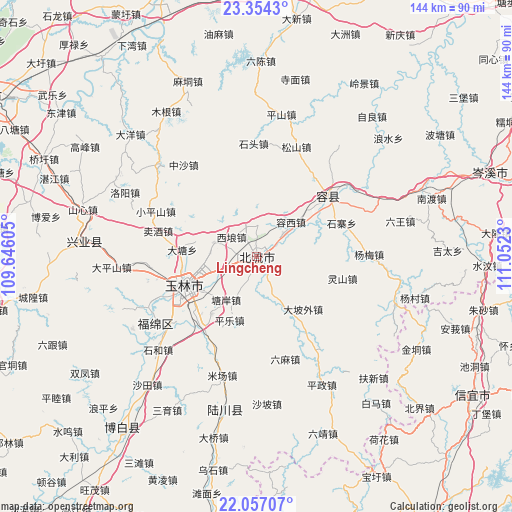
Lingcheng GPS coordinates[2]
22° 42' 25.992" North, 110° 20' 57.012" East
| Map corner | latitude | longitude |
|---|---|---|
| Upper-left | 23.3543°, | 109.64605° |
| Center: | 22.70722°, | 110.34917° |
| Lower-right: | 22.05707°, | 111.0523° |
| Map W x H: | 144.2×144.2 km | = 89.6×89.6mi |
| max Lat: | 53.31946° ⇑95.7% North |
| Lingcheng: | 22.70722° |
| min Lat: | ⇓4.3% South 18.22056° |
| min Long | Lingcheng | max Long |
| 75.07348° | 110.34917° | 134.28917° |
| W 30.3%⇐ | ⇒69.7% E |
Elevation
Elevation of Lingcheng is 102 m = 335 ft, and this is 382.8 m = 1256 ft below average elevation for this country.
| Max E: |
5622 m = 18445 ft | 59.4% |
| Avg. | 484.8 m = 1591 ft | |
| Lingcheng | 102 m = 335 ft | |
Min E: |
-3 m = -10 ft | 40.6% |
See also: Lingcheng elevation on elevation.city.
Geographical zone
Lingcheng is located in North Torrid zone (between Equator and Tropic of Cancer). Distance of this Northern Tropic circle is 81.1 km =50.4 mi to North.| Distance of | km | miles | from Lingcheng |
|---|---|---|---|
| North Pole | 7482.3 | 4649.3 | to North |
| Arctic Circle | 4876.4 | 3030.1 | to North |
| Tropic Cancer | 81.1 | 50.4 | to North |
| Equator | 2524.8 | 1568.8 | to South |


Nearby cities:
15 places around Lingcheng: (largest is in red/bold)
• Beijie
63.2 km =39.3 mi,  133°
133°
• Bobai
61.9 km =38.5 mi,  218°
218°
• Chidong
68.8 km =42.8 mi,  116°
116°
• Dongzhen
70.7 km =43.9 mi, 121°
• Hehua
63.2 km =39.3 mi,  145°
145°
• Jindong
52 km =32.3 mi, 121°
• Nandu
51.2 km =31.8 mi,  71°
71°
• Qiaoxu
66.4 km =41.3 mi,  294°
294°
• Rongcheng
26.3 km =16.3 mi,  50°
50°
• Shinan
48.9 km =30.4 mi,  274°
274°
• Wenlou
68.6 km =42.6 mi,  173°
173°
• Wenquan
43.5 km =27 mi,  192°
192°
• Yashan
70.5 km =43.8 mi, 216°
• Yulin
22 km =13.7 mi,  248°
248°
• Zhusha
65.2 km =40.5 mi,  103°
103°
Sources, notices
• [Note1] Compared only with cities in China existing in our database
• [Src1] Map data: © OpenStreetMap contributors (CC-BY-SA)
• [Src2] Other city data from geonames.org with taken over terms of usage.
• [Src3] Geographical zone / Annual Mean Temperature by Robert A. Rohde @ Wikipedia
