Liebu geodata
Liebu (Shanxi) is a seat of a fourth-order administrative division; located in China in Asia/Shanghai (GMT+8) time zone. In our database, there are 1268 cities with bigger population. Compared to other cities in China, 84.2% of cities are located further ↓South; 62.9% of cities are located further →East and 92.9% of cities have lower elevation than Liebu. Note1


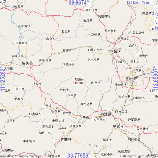
Liebu GPS coordinates[2]
39° 19' 32.196" North, 111° 57' 21.384" East
| Map corner | latitude | longitude |
|---|---|---|
| Upper-left | 39.8674°, | 111.25282° |
| Center: | 39.32561°, | 111.95594° |
| Lower-right: | 38.77959°, | 112.65907° |
| Map W x H: | 121×121 km | = 75.2×75.2mi |
| max Lat: | 53.31946° ⇑15.8% North |
| Liebu: | 39.32561° |
| min Lat: | ⇓84.2% South 18.22056° |
| min Long | Liebu | max Long |
| 75.07348° | 111.95594° | 134.28917° |
| W 37.1%⇐ | ⇒62.9% E |
Elevation
Elevation of Liebu is 1683 m = 5522 ft, and this is 1198.2 m = 3931 ft above average elevation for this country.
| Max E: |
5622 m = 18445 ft | 7.1% |
| Liebu | 1683 m 5522 ft | |
| Avg. | 484.8 m = 1591 ft | |
Min E: |
-3 m = -10 ft | 92.9% |
See also: China elevation on elevation.city.
Geographical zone
Liebu is located in North temperate zone (between Tropic of Cancer and the Arctic Circle). Distance of this Northern Tropic circle is 1766.7 km =1097.8 mi to South.| Distance of | km | miles | from Liebu |
|---|---|---|---|
| North Pole | 5634.5 | 3501.1 | to North |
| Arctic Circle | 3028.6 | 1881.9 | to North |
| Tropic Cancer | 1766.7 | 1097.8 | to South |
| Equator | 4372.6 | 2717 | to South |


Nearby cities:
15 places around Liebu: (largest is in red/bold)
• Baitang
34.5 km =21.4 mi,  67°
67°
• Bajiao
13.6 km =8.5 mi,  204°
204°
• Changzhen
13.9 km =8.6 mi,  234°
234°
• Dayanbei
19.7 km =12.2 mi,  163°
163°
• Donghu
29.1 km =18.1 mi,  152°
152°
• Hezhi
27.4 km =17 mi, 199°
• Jingping
35.5 km =22.1 mi,  52°
52°
• Limin
14.3 km =8.9 mi,  97°
97°
• Longquan
33.6 km =20.9 mi,  142°
142°
• Taipingzhuang
34.6 km =21.5 mi, 153°
• Xiamujiao
18.8 km =11.7 mi,  34°
34°
• Xiashuitou
24.9 km =15.5 mi, 25°
• Xiatuanpu
36.4 km =22.6 mi,  83°
83°
• Yijing
29.3 km =18.2 mi,  172°
172°
• Zhangcaizhuang
32.2 km =20 mi, 97°
Sources, notices
• [Note1] Compared only with cities in China existing in our database
• [Src1] Map data: © OpenStreetMap contributors (CC-BY-SA)
• [Src2] Other city data from geonames.org with taken over terms of usage.
• [Src3] Geographical zone / Annual Mean Temperature by Robert A. Rohde @ Wikipedia
