Changzhen geodata
Changzhen (Shanxi) is a seat of a fourth-order administrative division; located in China in Asia/Shanghai (GMT+8) time zone. In our database, there are 1268 cities with bigger population. Compared to other cities in China, 83.9% of cities are located further ↓South; 63.4% of cities are located further →East and 89.5% of cities have lower elevation than Changzhen. Note1


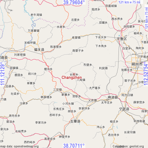
Changzhen GPS coordinates[2]
39° 15' 13.284" North, 111° 49' 27.876" East
| Map corner | latitude | longitude |
|---|---|---|
| Upper-left | 39.79604°, | 111.12129° |
| Center: | 39.25369°, | 111.82441° |
| Lower-right: | 38.70711°, | 112.52754° |
| Map W x H: | 121.1×121.1 km | = 75.2×75.2mi |
| max Lat: | 53.31946° ⇑16.1% North |
| Changzhen: | 39.25369° |
| min Lat: | ⇓83.9% South 18.22056° |
| min Long | Changzhen | max Long |
| 75.07348° | 111.82441° | 134.28917° |
| W 36.6%⇐ | ⇒63.4% E |
Elevation
Elevation of Changzhen is 1312 m = 4304 ft, and this is 827.2 m = 2714 ft above average elevation for this country.
| Max E: |
5622 m = 18445 ft | 10.5% |
| Changzhen | 1312 m 4304 ft | |
| Avg. | 484.8 m = 1591 ft | |
Min E: |
-3 m = -10 ft | 89.5% |
See also: China elevation on elevation.city.
Geographical zone
Changzhen is located in North temperate zone (between Tropic of Cancer and the Arctic Circle). Distance of this Northern Tropic circle is 1758.7 km =1092.8 mi to South.| Distance of | km | miles | from Changzhen |
|---|---|---|---|
| North Pole | 5642.5 | 3506.1 | to North |
| Arctic Circle | 3036.6 | 1886.9 | to North |
| Tropic Cancer | 1758.7 | 1092.8 | to South |
| Equator | 4364.6 | 2712 | to South |


Nearby cities:
15 places around Changzhen: (largest is in red/bold)
• Bajiao
7.2 km =4.5 mi,  127°
127°
• Dayanbei
20.2 km =12.6 mi,  122°
122°
• Donghu
30.6 km =19 mi, 125°
• Hezhi
18 km =11.2 mi,  172°
172°
• Hubei
32.6 km =20.3 mi,  150°
150°
• Liebu
13.9 km =8.6 mi,  54°
54°
• Limin
26.2 km =16.3 mi,  76°
76°
• Longquan
36.8 km =22.9 mi, 120°
• Taipingzhuang
35.3 km =21.9 mi, 130°
• Xiamujiao
32.1 km =19.9 mi,  43°
43°
• Xiashuitou
37.7 km =23.4 mi, 35°
• Xinguan
33.8 km =21 mi,  311°
311°
• Yancheng
37.8 km =23.5 mi, 174°
• Yijing
25.9 km =16.1 mi,  144°
144°
• Zhangcaizhuang
43.4 km =27 mi, 84°
Sources, notices
• [Note1] Compared only with cities in China existing in our database
• [Src1] Map data: © OpenStreetMap contributors (CC-BY-SA)
• [Src2] Other city data from geonames.org with taken over terms of usage.
• [Src3] Geographical zone / Annual Mean Temperature by Robert A. Rohde @ Wikipedia
