Licun geodata
Licun (Hebei) is a seat of a fourth-order administrative division; located in China in Asia/Shanghai (GMT+8) time zone. In our database, there are 1268 cities with bigger population. Compared to other cities in China, 81.3% of cities are located further ↓South; 50.6% of cities are located further ←West and 58.6% of cities have higher elevation than Licun. Note1


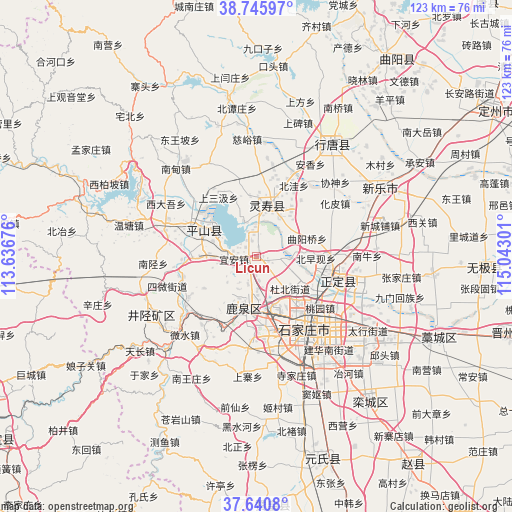
Licun GPS coordinates[2]
38° 11' 43.728" North, 114° 20' 23.568" East
| Map corner | latitude | longitude |
|---|---|---|
| Upper-left | 38.74597°, | 113.63676° |
| Center: | 38.19548°, | 114.33988° |
| Lower-right: | 37.6408°, | 115.04301° |
| Map W x H: | 122.9×122.9 km | = 76.4×76.4mi |
| max Lat: | 53.31946° ⇑18.7% North |
| Licun: | 38.19548° |
| min Lat: | ⇓81.3% South 18.22056° |
| min Long | Licun | max Long |
| 75.07348° | 114.33988° | 134.28917° |
| W 50.6%⇐ | ⇒49.4% E |
Elevation
Elevation of Licun is 107 m = 351 ft, and this is 377.8 m = 1240 ft below average elevation for this country.
| Max E: |
5622 m = 18445 ft | 58.6% |
| Avg. | 484.8 m = 1591 ft | |
| Licun | 107 m = 351 ft | |
Min E: |
-3 m = -10 ft | 41.4% |
See also: China elevation on elevation.city.
Geographical zone
Licun is located in North temperate zone (between Tropic of Cancer and the Arctic Circle). Distance of this Northern Tropic circle is 1641 km =1019.7 mi to South.| Distance of | km | miles | from Licun |
|---|---|---|---|
| North Pole | 5760.1 | 3579.2 | to North |
| Arctic Circle | 3154.2 | 1959.9 | to North |
| Tropic Cancer | 1641 | 1019.7 | to South |
| Equator | 4246.9 | 2638.9 | to South |


Nearby cities:
15 places around Licun: (largest is in red/bold)
• Bailuquan
15.2 km =9.4 mi,  204°
204°
• Beizaoxian
16.5 km =10.3 mi,  76°
76°
• Daguo
14.9 km =9.3 mi,  155°
155°
• Dahe
7.2 km =4.5 mi,  153°
153°
• Dubei
10.7 km =6.6 mi,  130°
130°
• Goutai
15.1 km =9.4 mi,  353°
353°
• Huangbizhuang
6.5 km =4 mi,  339°
339°
• Huolu
13.3 km =8.3 mi, 196°
• Niucheng
9.2 km =5.7 mi, 338°
• Quyangqiao
12.9 km =8 mi,  68°
68°
• Sanshengyuan
12.6 km =7.8 mi,  38°
38°
• Shangsanji
17.1 km =10.6 mi,  325°
325°
• Shijing
10.9 km =6.8 mi, 203°
• Yi’an
5.7 km =3.5 mi,  262°
262°
• Zhaolingpu
15.3 km =9.5 mi, 134°
Sources, notices
• [Note1] Compared only with cities in China existing in our database
• [Src1] Map data: © OpenStreetMap contributors (CC-BY-SA)
• [Src2] Other city data from geonames.org with taken over terms of usage.
• [Src3] Geographical zone / Annual Mean Temperature by Robert A. Rohde @ Wikipedia
