Shijing geodata
Shijing (Henan) is a seat of a fourth-order administrative division; located in China in Asia/Shanghai (GMT+8) time zone. In our database, there are 1268 cities with bigger population. Compared to other cities in China, 81.1% of cities are located further ↓South; 50.3% of cities are located further ←West and 52.4% of cities have higher elevation than Shijing. Note1


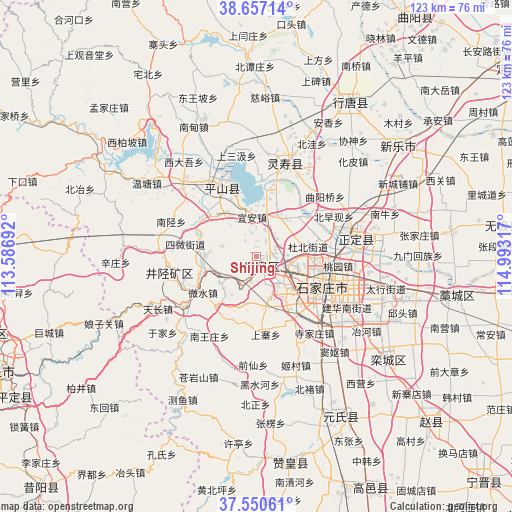
Shijing GPS coordinates[2]
38° 6' 21.492" North, 114° 17' 24.144" East
| Map corner | latitude | longitude |
|---|---|---|
| Upper-left | 38.65714°, | 113.58692° |
| Center: | 38.10597°, | 114.29004° |
| Lower-right: | 37.55061°, | 114.99317° |
| Map W x H: | 123×123 km | = 76.4×76.4mi |
| max Lat: | 53.31946° ⇑18.9% North |
| Shijing: | 38.10597° |
| min Lat: | ⇓81.1% South 18.22056° |
| min Long | Shijing | max Long |
| 75.07348° | 114.29004° | 134.28917° |
| W 50.3%⇐ | ⇒49.7% E |
Elevation
Elevation of Shijing is 147 m = 482 ft, and this is 337.8 m = 1108 ft below average elevation for this country.
| Max E: |
5622 m = 18445 ft | 52.4% |
| Avg. | 484.8 m = 1591 ft | |
| Shijing | 147 m = 482 ft | |
Min E: |
-3 m = -10 ft | 47.6% |
See also: China elevation on elevation.city.
Geographical zone
Shijing is located in North temperate zone (between Tropic of Cancer and the Arctic Circle). Distance of this Northern Tropic circle is 1631.1 km =1013.5 mi to South.| Distance of | km | miles | from Shijing |
|---|---|---|---|
| North Pole | 5770.1 | 3585.4 | to North |
| Arctic Circle | 3164.2 | 1966.1 | to North |
| Tropic Cancer | 1631.1 | 1013.5 | to South |
| Equator | 4237 | 2632.7 | to South |


Nearby cities:
15 places around Shijing: (largest is in red/bold)
• Bailuquan
4.3 km =2.7 mi,  204°
204°
• Daguo
11.1 km =6.9 mi,  108°
108°
• Dahe
8.4 km =5.2 mi,  64°
64°
• Dubei
12.8 km =8 mi,  76°
76°
• Huangbizhuang
16.2 km =10.1 mi,  7°
7°
• Huolu
2.9 km =1.8 mi,  169°
169°
• Licun
10.9 km =6.8 mi,  23°
23°
• Liuying
13 km =8.1 mi,  116°
116°
• Shangzhuang
10.9 km =6.8 mi,  139°
139°
• Shang’an
8.6 km =5.3 mi,  236°
236°
• Shijiazhuang
18 km =11.2 mi, 113°
• Sunzhuang
14.3 km =8.9 mi,  290°
290°
• Weizhou
12.3 km =7.6 mi,  270°
270°
• Yi’an
9.3 km =5.8 mi,  351°
351°
• Zhaolingpu
15.3 km =9.5 mi,  92°
92°
Sources, notices
• [Note1] Compared only with cities in China existing in our database
• [Src1] Map data: © OpenStreetMap contributors (CC-BY-SA)
• [Src2] Other city data from geonames.org with taken over terms of usage.
• [Src3] Geographical zone / Annual Mean Temperature by Robert A. Rohde @ Wikipedia
