Beizaoxian geodata
Beizaoxian (Henan) is a seat of a fourth-order administrative division; located in China in Asia/Shanghai (GMT+8) time zone. In our database, there are 1268 cities with bigger population. Compared to other cities in China, 81.3% of cities are located further ↓South; 51.7% of cities are located further ←West and 62.1% of cities have higher elevation than Beizaoxian. Note1


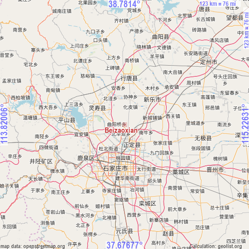
Beizaoxian GPS coordinates[2]
38° 13' 52.248" North, 114° 31' 23.448" East
| Map corner | latitude | longitude |
|---|---|---|
| Upper-left | 38.7814°, | 113.82006° |
| Center: | 38.23118°, | 114.52318° |
| Lower-right: | 37.67677°, | 115.22631° |
| Map W x H: | 122.8×122.8 km | = 76.3×76.3mi |
| max Lat: | 53.31946° ⇑18.7% North |
| Beizaoxian: | 38.23118° |
| min Lat: | ⇓81.3% South 18.22056° |
| min Long | Beizaoxian | max Long |
| 75.07348° | 114.52318° | 134.28917° |
| W 51.7%⇐ | ⇒48.3% E |
Elevation
Elevation of Beizaoxian is 87 m = 285 ft, and this is 397.8 m = 1305 ft below average elevation for this country.
| Max E: |
5622 m = 18445 ft | 62.1% |
| Avg. | 484.8 m = 1591 ft | |
| Beizaoxian | 87 m = 285 ft | |
Min E: |
-3 m = -10 ft | 37.9% |
See also: China elevation on elevation.city.
Geographical zone
Beizaoxian is located in North temperate zone (between Tropic of Cancer and the Arctic Circle). Distance of this Northern Tropic circle is 1645 km =1022.2 mi to South.| Distance of | km | miles | from Beizaoxian |
|---|---|---|---|
| North Pole | 5756.2 | 3576.7 | to North |
| Arctic Circle | 3150.3 | 1957.5 | to North |
| Tropic Cancer | 1645 | 1022.2 | to South |
| Equator | 4250.9 | 2641.4 | to South |


Nearby cities:
15 places around Beizaoxian: (largest is in red/bold)
• Beiwa
14.9 km =9.3 mi,  331°
331°
• Dahe
16.5 km =10.3 mi,  230°
230°
• Dubei
13.5 km =8.4 mi,  215°
215°
• Huapi
9.4 km =5.8 mi,  17°
17°
• Licun
16.5 km =10.3 mi,  256°
256°
• Nanlou
4.6 km =2.9 mi,  26°
26°
• Nanniu
11 km =6.8 mi,  110°
110°
• Quyangqiao
4.1 km =2.5 mi,  279°
279°
• Sanshengyuan
10 km =6.2 mi,  305°
305°
• Xieshen
13.9 km =8.6 mi,  11°
11°
• Xinchengpu
14.6 km =9.1 mi,  73°
73°
• Xin’an
7.3 km =4.5 mi,  95°
95°
• Xipingle
11.2 km =7 mi, 65°
• Zhaolingpu
15.6 km =9.7 mi,  199°
199°
• Zhufutun
13.5 km =8.4 mi,  127°
127°
Sources, notices
• [Note1] Compared only with cities in China existing in our database
• [Src1] Map data: © OpenStreetMap contributors (CC-BY-SA)
• [Src2] Other city data from geonames.org with taken over terms of usage.
• [Src3] Geographical zone / Annual Mean Temperature by Robert A. Rohde @ Wikipedia
