Lianhe geodata
Lianhe (Jiangxi) is a seat of a fourth-order administrative division; located in China in Asia/Shanghai (GMT+8) time zone. In our database, there are 1268 cities with bigger population. Compared to other cities in China, 70.8% of cities are located further ↑North; 69.1% of cities are located further ←West and 63.7% of cities have higher elevation than Lianhe. Note1


Lianhe GPS coordinates[2]
28° 22' 59.988" North, 117° 34' 59.988" East
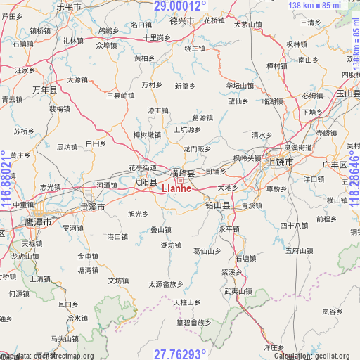
| Map corner | latitude | longitude |
|---|---|---|
| Upper-left | 29.00012°, | 116.88021° |
| Center: | 28.38333°, | 117.58333° |
| Lower-right: | 27.76293°, | 118.28646° |
| Map W x H: | 137.6×137.6 km | = 85.5×85.5mi |
| max Lat: | 53.31946° ⇑70.8% North |
| Lianhe: | 28.38333° |
| min Lat: | ⇓29.2% South 18.22056° |
| min Long | Lianhe | max Long |
| 75.07348° | 117.58333° | 134.28917° |
| W 69.1%⇐ | ⇒30.9% E |
Elevation
Elevation of Lianhe is 79 m = 259 ft, and this is 405.8 m = 1331 ft below average elevation for this country.
| Max E: |
5622 m = 18445 ft | 63.7% |
| Avg. | 484.8 m = 1591 ft | |
| Lianhe | 79 m = 259 ft | |
Min E: |
-3 m = -10 ft | 36.3% |
See also: China elevation on elevation.city.
Geographical zone
Lianhe is located in North temperate zone (between Tropic of Cancer and the Arctic Circle). Distance of this Northern Tropic circle is 550 km =341.8 mi to South.| Distance of | km | miles | from Lianhe |
|---|---|---|---|
| North Pole | 6851.1 | 4257.1 | to North |
| Arctic Circle | 4245.2 | 2637.8 | to North |
| Tropic Cancer | 550 | 341.8 | to South |
| Equator | 3155.9 | 1961 | to South |


Nearby cities:
15 places around Lianhe: (largest is in red/bold)
• Gangbian
13.9 km =8.6 mi,  48°
48°
• Hekou
14.4 km =8.9 mi,  121°
121°
• Huating
14.9 km =9.3 mi,  292°
292°
• Lianhe
4.7 km =2.9 mi,  82°
82°
• Lingyang
5.1 km =3.2 mi,  28°
28°
• Longmenfan
14.6 km =9.1 mi, 26°
• Nanyan
13.4 km =8.3 mi,  277°
277°
• Puqian
10.4 km =6.5 mi,  16°
16°
• Qingban
14.1 km =8.8 mi,  355°
355°
• Sipu
13.6 km =8.5 mi,  64°
64°
• Wang’er
12.3 km =7.6 mi,  212°
212°
• Xintan
10.9 km =6.8 mi, 120°
• Xin’anbu
13 km =8.1 mi,  175°
175°
• Yiyang
15 km =9.3 mi, 279°
• Zhukeng
7 km =4.3 mi, 278°
Sources, notices
• [Note1] Compared only with cities in China existing in our database
• [Src1] Map data: © OpenStreetMap contributors (CC-BY-SA)
• [Src2] Other city data from geonames.org with taken over terms of usage.
• [Src3] Geographical zone / Annual Mean Temperature by Robert A. Rohde @ Wikipedia
