Lianhe geodata
Lianhe (Jiangxi) is a seat of a fourth-order administrative division; located in China in Asia/Shanghai (GMT+8) time zone. In our database, there are 1268 cities with bigger population. Compared to other cities in China, 70.7% of cities are located further ↑North; 69.2% of cities are located further ←West and 67.6% of cities have higher elevation than Lianhe. Note1


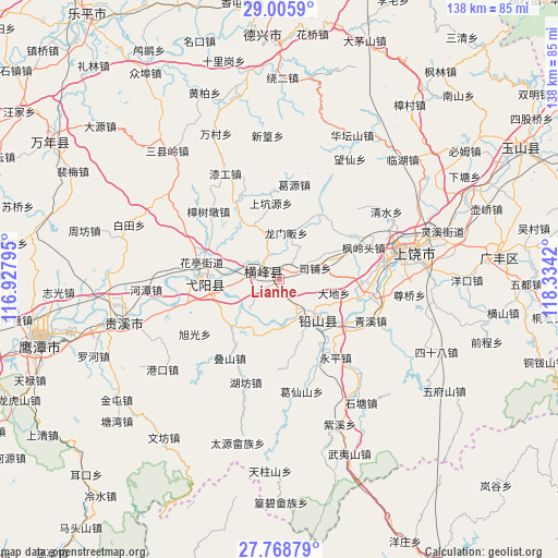
Lianhe GPS coordinates[2]
28° 23' 20.94" North, 117° 37' 51.852" East
| Map corner | latitude | longitude |
|---|---|---|
| Upper-left | 29.0059°, | 116.92795° |
| Center: | 28.38915°, | 117.63107° |
| Lower-right: | 27.76879°, | 118.3342° |
| Map W x H: | 137.6×137.6 km | = 85.5×85.5mi |
| max Lat: | 53.31946° ⇑70.7% North |
| Lianhe: | 28.38915° |
| min Lat: | ⇓29.3% South 18.22056° |
| min Long | Lianhe | max Long |
| 75.07348° | 117.63107° | 134.28917° |
| W 69.2%⇐ | ⇒30.8% E |
Elevation
Elevation of Lianhe is 62 m = 203 ft, and this is 422.8 m = 1387 ft below average elevation for this country.
| Max E: |
5622 m = 18445 ft | 67.6% |
| Avg. | 484.8 m = 1591 ft | |
| Lianhe | 62 m = 203 ft | |
Min E: |
-3 m = -10 ft | 32.4% |
See also: China elevation on elevation.city.
Geographical zone
Lianhe is located in North temperate zone (between Tropic of Cancer and the Arctic Circle). Distance of this Northern Tropic circle is 550.7 km =342.2 mi to South.| Distance of | km | miles | from Lianhe |
|---|---|---|---|
| North Pole | 6850.5 | 4256.7 | to North |
| Arctic Circle | 4244.6 | 2637.5 | to North |
| Tropic Cancer | 550.7 | 342.2 | to South |
| Equator | 3156.6 | 1961.4 | to South |


Nearby cities:
15 places around Lianhe: (largest is in red/bold)
• Gangbian
10.3 km =6.4 mi,  33°
33°
• Hekou
11.1 km =6.9 mi,  137°
137°
• Hongqiao
16.4 km =10.2 mi,  161°
161°
• Lianhe
4.7 km =2.9 mi,  262°
262°
• Lingyang
4.4 km =2.7 mi,  329°
329°
• Longmenfan
12.5 km =7.8 mi,  9°
9°
• Nanyan
18 km =11.2 mi,  273°
273°
• Puqian
9.5 km =5.9 mi,  349°
349°
• Qingban
14.6 km =9.1 mi,  336°
336°
• Qingban
17.1 km =10.6 mi, 326°
• Sipu
9.2 km =5.7 mi,  55°
55°
• Wang’er
15.8 km =9.8 mi,  225°
225°
• Xintan
7.8 km =4.8 mi, 142°
• Xin’anbu
14 km =8.7 mi,  194°
194°
• Zhukeng
11.6 km =7.2 mi, 271°
Sources, notices
• [Note1] Compared only with cities in China existing in our database
• [Src1] Map data: © OpenStreetMap contributors (CC-BY-SA)
• [Src2] Other city data from geonames.org with taken over terms of usage.
• [Src3] Geographical zone / Annual Mean Temperature by Robert A. Rohde @ Wikipedia
