Liangzhu geodata
Liangzhu (Zhejiang) is a seat of a fourth-order administrative division; located in China in Asia/Shanghai (GMT+8) time zone. In our database, there are 1268 cities with bigger population. Compared to other cities in China, 50.5% of cities are located further ↑North; 82.2% of cities are located further ←West and 89.9% of cities have higher elevation than Liangzhu. Note1


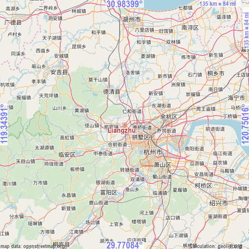
Liangzhu GPS coordinates[2]
30° 22' 45.48" North, 120° 2' 49.308" East
| Map corner | latitude | longitude |
|---|---|---|
| Upper-left | 30.98399°, | 119.34391° |
| Center: | 30.3793°, | 120.04703° |
| Lower-right: | 29.77084°, | 120.75016° |
| Map W x H: | 134.9×134.9 km | = 83.8×83.8mi |
| max Lat: | 53.31946° ⇑50.5% North |
| Liangzhu: | 30.3793° |
| min Lat: | ⇓49.5% South 18.22056° |
| min Long | Liangzhu | max Long |
| 75.07348° | 120.04703° | 134.28917° |
| W 82.2%⇐ | ⇒17.8% E |
Elevation
Elevation of Liangzhu is 10 m = 33 ft, and this is 474.8 m = 1558 ft below average elevation for this country.
| Max E: |
5622 m = 18445 ft | 89.9% |
| Avg. | 484.8 m = 1591 ft | |
| Liangzhu | 10 m = 33 ft | |
Min E: |
-3 m = -10 ft | 10.1% |
See also: China elevation on elevation.city.
Geographical zone
Liangzhu is located in North temperate zone (between Tropic of Cancer and the Arctic Circle). Distance of this Northern Tropic circle is 771.9 km =479.6 mi to South.| Distance of | km | miles | from Liangzhu |
|---|---|---|---|
| North Pole | 6629.2 | 4119.2 | to North |
| Arctic Circle | 4023.3 | 2500 | to North |
| Tropic Cancer | 771.9 | 479.6 | to South |
| Equator | 3377.9 | 2098.9 | to South |


Nearby cities:
15 places around Liangzhu: (largest is in red/bold)
• Banshan
12.9 km =8 mi,  103°
103°
• Cangqian
11.2 km =7 mi,  208°
208°
• Chongxian
11.9 km =7.4 mi,  85°
85°
• Gongchenqiao
10.7 km =6.6 mi,  130°
130°
• Gudang
13.1 km =8.1 mi,  148°
148°
• Jiangcun
10.5 km =6.5 mi,  170°
170°
• Kangqiao
9.4 km =5.8 mi, 99°
• Mishixiang
13.2 km =8.2 mi,  135°
135°
• Pingyao
8.4 km =5.2 mi,  286°
286°
• Renhe
7.9 km =4.9 mi,  20°
20°
• Sandun
6.7 km =4.2 mi, 154°
• Sanhe
11.2 km =7 mi,  353°
353°
• Shangtang
12.2 km =7.6 mi, 125°
• Xiangfu
7.4 km =4.6 mi, 137°
• Xiaohe
11.4 km =7.1 mi, 132°
Sources, notices
• [Note1] Compared only with cities in China existing in our database
• [Src1] Map data: © OpenStreetMap contributors (CC-BY-SA)
• [Src2] Other city data from geonames.org with taken over terms of usage.
• [Src3] Geographical zone / Annual Mean Temperature by Robert A. Rohde @ Wikipedia
