Lianghekou geodata
Lianghekou (Hubei) is a seat of a fourth-order administrative division; located in China in Asia/Shanghai (GMT+8) time zone. In our database, there are 1268 cities with bigger population. Compared to other cities in China, 53.6% of cities are located further ↓South; 68.8% of cities are located further →East and 71.2% of cities have lower elevation than Lianghekou. Note1


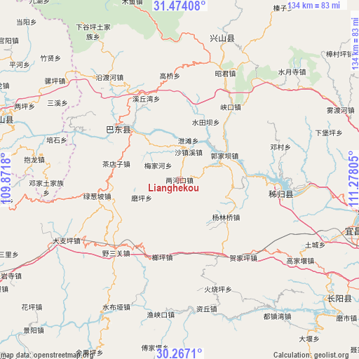
Lianghekou GPS coordinates[2]
30° 52' 20.964" North, 110° 34' 29.712" East
| Map corner | latitude | longitude |
|---|---|---|
| Upper-left | 31.47408°, | 109.8718° |
| Center: | 30.87249°, | 110.57492° |
| Lower-right: | 30.2671°, | 111.27805° |
| Map W x H: | 134.2×134.2 km | = 83.4×83.4mi |
| max Lat: | 53.31946° ⇑46.4% North |
| Lianghekou: | 30.87249° |
| min Lat: | ⇓53.6% South 18.22056° |
| min Long | Lianghekou | max Long |
| 75.07348° | 110.57492° | 134.28917° |
| W 31.2%⇐ | ⇒68.8% E |
Elevation
Elevation of Lianghekou is 435 m = 1427 ft, and this is 49.8 m = 163 ft below average elevation for this country.
| Max E: |
5622 m = 18445 ft | 28.8% |
| Avg. | 484.8 m = 1591 ft | |
| Lianghekou | 435 m = 1427 ft | |
Min E: |
-3 m = -10 ft | 71.2% |
See also: China elevation on elevation.city.
Geographical zone
Lianghekou is located in North temperate zone (between Tropic of Cancer and the Arctic Circle). Distance of this Northern Tropic circle is 826.8 km =513.7 mi to South.| Distance of | km | miles | from Lianghekou |
|---|---|---|---|
| North Pole | 6574.4 | 4085.1 | to North |
| Arctic Circle | 3968.5 | 2465.9 | to North |
| Tropic Cancer | 826.8 | 513.7 | to South |
| Equator | 3432.7 | 2133 | to South |


Nearby cities:
15 places around Lianghekou: (largest is in red/bold)
• Chadianzi
24.4 km =15.2 mi,  284°
284°
• Guandukou
31.4 km =19.5 mi,  306°
306°
• Guizhou
17.6 km =10.9 mi,  38°
38°
• Guojiaba
15.7 km =9.8 mi,  69°
69°
• Langping
29.5 km =18.3 mi,  192°
192°
• Lücongpo
31.4 km =19.5 mi,  259°
259°
• Meijiahe
10 km =6.2 mi,  301°
301°
• Moping
15.6 km =9.7 mi,  244°
244°
• Quyuan
25.2 km =15.7 mi, 73°
• Shazhenxi
9.9 km =6.2 mi,  14°
14°
• Shuitianba
22.9 km =14.2 mi,  25°
25°
• Xietan
16 km =9.9 mi,  15°
15°
• Xinling
29.8 km =18.5 mi, 304°
• Yanglinqiao
22.3 km =13.9 mi,  127°
127°
• Zhouping
19.8 km =12.3 mi,  99°
99°
Sources, notices
• [Note1] Compared only with cities in China existing in our database
• [Src1] Map data: © OpenStreetMap contributors (CC-BY-SA)
• [Src2] Other city data from geonames.org with taken over terms of usage.
• [Src3] Geographical zone / Annual Mean Temperature by Robert A. Rohde @ Wikipedia
