Lianfeng geodata
Lianfeng (Fujian) is a seat of a third-order administrative division; located in China in Asia/Shanghai (GMT+8) time zone. In our database, there are 1268 cities with bigger population. Compared to other cities in China, 83.5% of cities are located further ↑North; 64.5% of cities are located further ←West and 69.3% of cities have lower elevation than Lianfeng. Note1


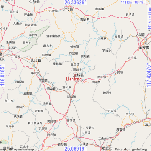
Lianfeng GPS coordinates[2]
25° 42' 15.876" North, 116° 43' 17.832" East
| Map corner | latitude | longitude |
|---|---|---|
| Upper-left | 26.33626°, | 116.0185° |
| Center: | 25.70441°, | 116.72162° |
| Lower-right: | 25.06919°, | 117.42475° |
| Map W x H: | 140.9×140.9 km | = 87.6×87.6mi |
| max Lat: | 53.31946° ⇑83.5% North |
| Lianfeng: | 25.70441° |
| min Lat: | ⇓16.5% South 18.22056° |
| min Long | Lianfeng | max Long |
| 75.07348° | 116.72162° | 134.28917° |
| W 64.5%⇐ | ⇒35.5% E |
Elevation
Elevation of Lianfeng is 397 m = 1302 ft, and this is 87.8 m = 288 ft below average elevation for this country.
| Max E: |
5622 m = 18445 ft | 30.7% |
| Avg. | 484.8 m = 1591 ft | |
| Lianfeng | 397 m = 1302 ft | |
Min E: |
-3 m = -10 ft | 69.3% |
See also: China elevation on elevation.city.
Geographical zone
Lianfeng is located in North temperate zone (between Tropic of Cancer and the Arctic Circle). Distance of this Northern Tropic circle is 252.1 km =156.6 mi to South.| Distance of | km | miles | from Lianfeng |
|---|---|---|---|
| North Pole | 7149 | 4442.2 | to North |
| Arctic Circle | 4543.1 | 2823 | to North |
| Tropic Cancer | 252.1 | 156.6 | to South |
| Equator | 2858.1 | 1775.9 | to South |


Nearby cities:
15 places around Lianfeng: (largest is in red/bold)
• Beituan
10.6 km =6.6 mi,  357°
357°
• Gechuan
6.1 km =3.8 mi,  17°
17°
• Gutian
24.5 km =15.2 mi,  92°
92°
• Jiele
6.7 km =4.2 mi,  66°
66°
• Juxi
23.4 km =14.5 mi,  175°
175°
• Lijia
15.2 km =9.4 mi,  25°
25°
• Lingdi
20.5 km =12.7 mi, 26°
• Liwu
16 km =9.9 mi,  112°
112°
• Luofang
6.4 km =4 mi,  323°
323°
• Pengkou
19.6 km =12.2 mi,  190°
190°
• Quxi
20.2 km =12.6 mi, 106°
• Sibao
21.3 km =13.2 mi, 355°
• Tongfang
20.4 km =12.7 mi,  302°
302°
• Wenheng
5.3 km =3.3 mi,  141°
141°
• Xuanhe
13.2 km =8.2 mi,  217°
217°
Sources, notices
• [Note1] Compared only with cities in China existing in our database
• [Src1] Map data: © OpenStreetMap contributors (CC-BY-SA)
• [Src2] Other city data from geonames.org with taken over terms of usage.
• [Src3] Geographical zone / Annual Mean Temperature by Robert A. Rohde @ Wikipedia
