Lingdi geodata
Lingdi (Fujian) is a seat of a fourth-order administrative division; located in China in Asia/Shanghai (GMT+8) time zone. In our database, there are 1268 cities with bigger population. Compared to other cities in China, 82.9% of cities are located further ↑North; 65% of cities are located further ←West and 66.7% of cities have lower elevation than Lingdi. Note1


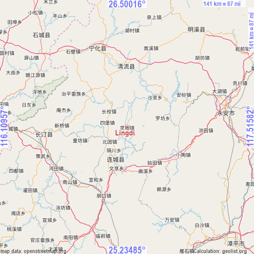
Lingdi GPS coordinates[2]
25° 52' 9.12" North, 116° 48' 45.684" East
| Map corner | latitude | longitude |
|---|---|---|
| Upper-left | 26.50016°, | 116.10957° |
| Center: | 25.8692°, | 116.81269° |
| Lower-right: | 25.23485°, | 117.51582° |
| Map W x H: | 140.7×140.7 km | = 87.4×87.4mi |
| max Lat: | 53.31946° ⇑82.9% North |
| Lingdi: | 25.8692° |
| min Lat: | ⇓17.1% South 18.22056° |
| min Long | Lingdi | max Long |
| 75.07348° | 116.81269° | 134.28917° |
| W 65%⇐ | ⇒35% E |
Elevation
Elevation of Lingdi is 355 m = 1165 ft, and this is 129.8 m = 426 ft below average elevation for this country.
| Max E: |
5622 m = 18445 ft | 33.3% |
| Avg. | 484.8 m = 1591 ft | |
| Lingdi | 355 m = 1165 ft | |
Min E: |
-3 m = -10 ft | 66.7% |
See also: China elevation on elevation.city.
Geographical zone
Lingdi is located in North temperate zone (between Tropic of Cancer and the Arctic Circle). Distance of this Northern Tropic circle is 270.5 km =168.1 mi to South.| Distance of | km | miles | from Lingdi |
|---|---|---|---|
| North Pole | 7130.7 | 4430.8 | to North |
| Arctic Circle | 4524.8 | 2811.6 | to North |
| Tropic Cancer | 270.5 | 168.1 | to South |
| Equator | 2876.4 | 1787.3 | to South |


Nearby cities:
15 places around Lingdi: (largest is in red/bold)
• Beituan
12.3 km =7.6 mi,  231°
231°
• Dengjia
5.9 km =3.7 mi,  26°
26°
• Gechuan
14.4 km =8.9 mi,  210°
210°
• Jiele
15.9 km =9.9 mi,  190°
190°
• Laifang
10.3 km =6.4 mi,  43°
43°
• Lianfeng
20.5 km =12.7 mi, 206°
• Lijia
5.3 km =3.3 mi, 209°
• Litian
19.8 km =12.3 mi,  325°
325°
• Luofang
18.4 km =11.4 mi,  224°
224°
• Luofang
20.1 km =12.5 mi,  76°
76°
• Shawu
22.8 km =14.2 mi, 42°
• Sibao
11 km =6.8 mi,  285°
285°
• Tianyuan
20.8 km =12.9 mi,  8°
8°
• Wenheng
23.2 km =14.4 mi, 194°
• Xiaoxi
13.5 km =8.4 mi,  312°
312°
Sources, notices
• [Note1] Compared only with cities in China existing in our database
• [Src1] Map data: © OpenStreetMap contributors (CC-BY-SA)
• [Src2] Other city data from geonames.org with taken over terms of usage.
• [Src3] Geographical zone / Annual Mean Temperature by Robert A. Rohde @ Wikipedia
