Langqiao geodata
Langqiao (Anhui) is a seat of a fourth-order administrative division; located in China in Asia/Shanghai (GMT+8) time zone. In our database, there are 1268 cities with bigger population. Compared to other cities in China, 50.2% of cities are located further ↓South; 72.9% of cities are located further ←West and 53.1% of cities have higher elevation than Langqiao. Note1


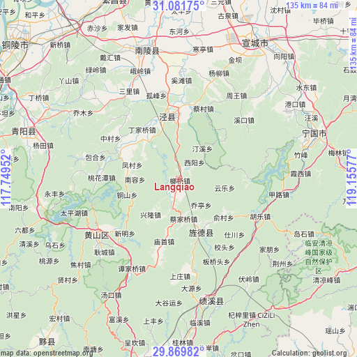
Langqiao GPS coordinates[2]
30° 28' 39.612" North, 118° 27' 9.504" East
| Map corner | latitude | longitude |
|---|---|---|
| Upper-left | 31.08175°, | 117.74952° |
| Center: | 30.47767°, | 118.45264° |
| Lower-right: | 29.86982°, | 119.15577° |
| Map W x H: | 134.8×134.8 km | = 83.8×83.8mi |
| max Lat: | 53.31946° ⇑49.8% North |
| Langqiao: | 30.47767° |
| min Lat: | ⇓50.2% South 18.22056° |
| min Long | Langqiao | max Long |
| 75.07348° | 118.45264° | 134.28917° |
| W 72.9%⇐ | ⇒27.1% E |
Elevation
Elevation of Langqiao is 143 m = 469 ft, and this is 341.8 m = 1121 ft below average elevation for this country.
| Max E: |
5622 m = 18445 ft | 53.1% |
| Avg. | 484.8 m = 1591 ft | |
| Langqiao | 143 m = 469 ft | |
Min E: |
-3 m = -10 ft | 46.9% |
See also: China elevation on elevation.city.
Geographical zone
Langqiao is located in North temperate zone (between Tropic of Cancer and the Arctic Circle). Distance of this Northern Tropic circle is 782.9 km =486.5 mi to South.| Distance of | km | miles | from Langqiao |
|---|---|---|---|
| North Pole | 6618.3 | 4112.4 | to North |
| Arctic Circle | 4012.4 | 2493.2 | to North |
| Tropic Cancer | 782.9 | 486.5 | to South |
| Equator | 3388.8 | 2105.7 | to South |


Nearby cities:
15 places around Langqiao: (largest is in red/bold)
• Caijiaqiao
15.1 km =9.4 mi,  173°
173°
• Huangcun
18.9 km =11.7 mi,  320°
320°
• Huatan
18.5 km =11.5 mi,  153°
153°
• Maolin
19.9 km =12.4 mi,  280°
280°
• Qiaoting
13.4 km =8.3 mi,  137°
137°
• Sanxi
11.4 km =7.1 mi,  192°
192°
• Suhong
14.4 km =8.9 mi,  38°
38°
• Suncun
18.4 km =11.4 mi, 191°
• Tingxi
20.8 km =12.9 mi,  46°
46°
• Tongshan
20.4 km =12.7 mi,  253°
253°
• Xinglong
17.2 km =10.7 mi,  218°
218°
• Xiyang
8.5 km =5.3 mi, 43°
• Yangong
19.2 km =11.9 mi,  359°
359°
• Yucun
22.3 km =13.9 mi,  129°
129°
• Yunle
17.6 km =10.9 mi,  100°
100°
Sources, notices
• [Note1] Compared only with cities in China existing in our database
• [Src1] Map data: © OpenStreetMap contributors (CC-BY-SA)
• [Src2] Other city data from geonames.org with taken over terms of usage.
• [Src3] Geographical zone / Annual Mean Temperature by Robert A. Rohde @ Wikipedia
