Langfang geodata
Langfang (Hebei) is a populated place; located in China in Asia/Shanghai (GMT+8) time zone. With population of 720,119 people, there are 84 cities with bigger population in this country. Compared to other cities in China, 84.7% of cities are located further ↓South; 64.3% of cities are located further ←West and 83.9% of cities have higher elevation than Langfang. Note1


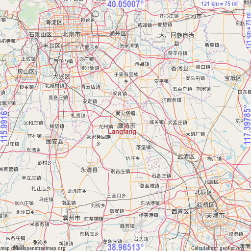
Langfang GPS coordinates[2]
39° 30' 34.992" North, 116° 41' 40.992" East
| Map corner | latitude | longitude |
|---|---|---|
| Upper-left | 40.05007°, | 115.9916° |
| Center: | 39.50972°, | 116.69472° |
| Lower-right: | 38.96513°, | 117.39785° |
| Map W x H: | 120.6×120.6 km | = 74.9×74.9mi |
| max Lat: | 53.31946° ⇑15.3% North |
| Langfang: | 39.50972° |
| min Lat: | ⇓84.7% South 18.22056° |
| min Long | Langfang | max Long |
| 75.07348° | 116.69472° | 134.28917° |
| W 64.3%⇐ | ⇒35.7% E |
Elevation
Elevation of Langfang is 18 m = 59 ft, and this is 466.8 m = 1531 ft below average elevation for this country.
| Max E: |
5622 m = 18445 ft | 83.9% |
| Avg. | 484.8 m = 1591 ft | |
| Langfang | 18 m = 59 ft | |
Min E: |
-3 m = -10 ft | 16.1% |
See also: Langfang elevation on elevation.city.
Geographical zone
Langfang is located in North temperate zone (between Tropic of Cancer and the Arctic Circle). Distance of this Northern Tropic circle is 1787.2 km =1110.5 mi to South.| Distance of | km | miles | from Langfang |
|---|---|---|---|
| North Pole | 5614 | 3488.4 | to North |
| Arctic Circle | 3008.1 | 1869.1 | to North |
| Tropic Cancer | 1787.2 | 1110.5 | to South |
| Equator | 4393.1 | 2729.7 | to South |


Nearby cities:
15 places around Langfang: (largest is in red/bold)
• Anding
21.3 km =13.2 mi,  304°
304°
• Beicaicun
28.5 km =17.7 mi,  95°
95°
• Caiyu
17.1 km =10.6 mi,  337°
337°
• Dadunqiu
31.2 km =19.4 mi,  111°
111°
• Huoxian
30.5 km =19 mi,  14°
14°
• Lixian
21.8 km =13.5 mi,  283°
283°
• Nancaicun
27.8 km =17.3 mi, 97°
• Qingyundian
24.6 km =15.3 mi,  319°
319°
• Shigezhuang
29.1 km =18.1 mi,  144°
144°
• Shuangshu
28.9 km =18 mi,  77°
77°
• Weishanzhuang
27.3 km =17 mi, 299°
• Yongledian
23.2 km =14.4 mi,  17°
17°
• Yufa
32.6 km =20.3 mi,  271°
271°
• Yujiawu
23.5 km =14.6 mi,  1°
1°
• Zhangziying
21.1 km =13.1 mi, 335°
Sources, notices
• [Note1] Compared only with cities in China existing in our database
• [Src1] Map data: © OpenStreetMap contributors (CC-BY-SA)
• [Src2] Other city data from geonames.org with taken over terms of usage.
• [Src3] Geographical zone / Annual Mean Temperature by Robert A. Rohde @ Wikipedia
