Kangshan geodata
Kangshan (Jiangxi) is a seat of a fourth-order administrative division; located in China in Asia/Shanghai (GMT+8) time zone. In our database, there are 1268 cities with bigger population. Compared to other cities in China, 66.5% of cities are located further ↑North; 62.7% of cities are located further ←West and 81.6% of cities have higher elevation than Kangshan. Note1


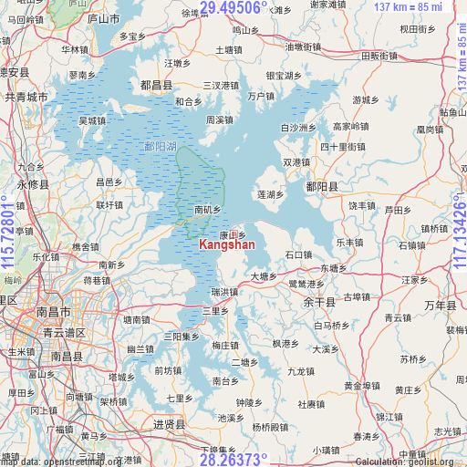
Kangshan GPS coordinates[2]
28° 52' 52.392" North, 116° 25' 52.068" East
| Map corner | latitude | longitude |
|---|---|---|
| Upper-left | 29.49506°, | 115.72801° |
| Center: | 28.88122°, | 116.43113° |
| Lower-right: | 28.26373°, | 117.13426° |
| Map W x H: | 136.9×136.9 km | = 85.1×85.1mi |
| max Lat: | 53.31946° ⇑66.5% North |
| Kangshan: | 28.88122° |
| min Lat: | ⇓33.5% South 18.22056° |
| min Long | Kangshan | max Long |
| 75.07348° | 116.43113° | 134.28917° |
| W 62.7%⇐ | ⇒37.3% E |
Elevation
Elevation of Kangshan is 23 m = 75 ft, and this is 461.8 m = 1515 ft below average elevation for this country.
| Max E: |
5622 m = 18445 ft | 81.6% |
| Avg. | 484.8 m = 1591 ft | |
| Kangshan | 23 m = 75 ft | |
Min E: |
-3 m = -10 ft | 18.4% |
See also: China elevation on elevation.city.
Geographical zone
Kangshan is located in North temperate zone (between Tropic of Cancer and the Arctic Circle). Distance of this Northern Tropic circle is 605.4 km =376.2 mi to South.| Distance of | km | miles | from Kangshan |
|---|---|---|---|
| North Pole | 6795.8 | 4222.7 | to North |
| Arctic Circle | 4189.9 | 2603.5 | to North |
| Tropic Cancer | 605.4 | 376.2 | to South |
| Equator | 3211.3 | 1995.4 | to South |


Nearby cities:
15 places around Kangshan: (largest is in red/bold)
• Datang
14.1 km =8.8 mi,  143°
143°
• Dongyuan
12.4 km =7.7 mi,  172°
172°
• Hongjiazui
30 km =18.6 mi,  132°
132°
• Hualingang
32.1 km =19.9 mi, 127°
• Jiangbu
31.4 km =19.5 mi,  152°
152°
• Jinshanzui
20.7 km =12.9 mi, 142°
• Lianhu
16.7 km =10.4 mi,  40°
40°
• Lusigang
25.6 km =15.9 mi,  123°
123°
• Meixi
12.6 km =7.8 mi,  196°
196°
• Poyang
26.1 km =16.2 mi,  61°
61°
• Ruihong
17 km =10.6 mi,  188°
188°
• Sanli
22.9 km =14.2 mi, 192°
• Santang
21 km =13 mi, 140°
• Shikou
19.8 km =12.3 mi,  107°
107°
• Shuanggang
28 km =17.4 mi, 39°
Sources, notices
• [Note1] Compared only with cities in China existing in our database
• [Src1] Map data: © OpenStreetMap contributors (CC-BY-SA)
• [Src2] Other city data from geonames.org with taken over terms of usage.
• [Src3] Geographical zone / Annual Mean Temperature by Robert A. Rohde @ Wikipedia
