Kangle geodata
Kangle (Jiangxi) is a seat of a third-order administrative division; located in China in Asia/Shanghai (GMT+8) time zone. In our database, there are 1268 cities with bigger population. Compared to other cities in China, 73.3% of cities are located further ↑North; 51.3% of cities are located further ←West and 61.1% of cities have higher elevation than Kangle. Note1


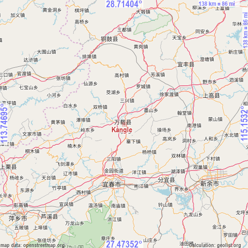
Kangle GPS coordinates[2]
28° 5' 44.052" North, 114° 27' 0.252" East
| Map corner | latitude | longitude |
|---|---|---|
| Upper-left | 28.71404°, | 113.74695° |
| Center: | 28.09557°, | 114.45007° |
| Lower-right: | 27.47352°, | 115.1532° |
| Map W x H: | 137.9×137.9 km | = 85.7×85.7mi |
| max Lat: | 53.31946° ⇑73.3% North |
| Kangle: | 28.09557° |
| min Lat: | ⇓26.7% South 18.22056° |
| min Long | Kangle | max Long |
| 75.07348° | 114.45007° | 134.28917° |
| W 51.3%⇐ | ⇒48.7% E |
Elevation
Elevation of Kangle is 92 m = 302 ft, and this is 392.8 m = 1289 ft below average elevation for this country.
| Max E: |
5622 m = 18445 ft | 61.1% |
| Avg. | 484.8 m = 1591 ft | |
| Kangle | 92 m = 302 ft | |
Min E: |
-3 m = -10 ft | 38.9% |
See also: China elevation on elevation.city.
Geographical zone
Kangle is located in North temperate zone (between Tropic of Cancer and the Arctic Circle). Distance of this Northern Tropic circle is 518 km =321.9 mi to South.| Distance of | km | miles | from Kangle |
|---|---|---|---|
| North Pole | 6883.1 | 4277 | to North |
| Arctic Circle | 4277.2 | 2657.7 | to North |
| Tropic Cancer | 518 | 321.9 | to South |
| Equator | 3123.9 | 1941.1 | to South |


Nearby cities:
15 places around Kangle: (largest is in red/bold)
• Bailiang
12.3 km =7.6 mi,  342°
342°
• Baimu
10.6 km =6.6 mi,  189°
189°
• Efeng
1.8 km =1.1 mi,  7°
7°
• Fengdingshan
18.8 km =11.7 mi,  240°
240°
• Gaocheng
9.9 km =6.2 mi,  274°
274°
• Jiaohu
19.2 km =11.9 mi, 340°
• Lucun
18.7 km =11.6 mi,  178°
178°
• Mabu
1.3 km =0.8 mi,  293°
293°
• Sanxing
13.4 km =8.3 mi,  4°
4°
• Sanyang
20.1 km =12.5 mi,  197°
197°
• Shuangqiao
16.7 km =10.4 mi,  305°
305°
• Siquanpu
16.8 km =10.4 mi,  61°
61°
• Tianxin
15.7 km =9.8 mi,  73°
73°
• Zhaixia
10.5 km =6.5 mi,  154°
154°
• Zhendu
18.9 km =11.7 mi,  50°
50°
Sources, notices
• [Note1] Compared only with cities in China existing in our database
• [Src1] Map data: © OpenStreetMap contributors (CC-BY-SA)
• [Src2] Other city data from geonames.org with taken over terms of usage.
• [Src3] Geographical zone / Annual Mean Temperature by Robert A. Rohde @ Wikipedia
