Fengdingshan geodata
Fengdingshan (Jiangxi) is a seat of a fourth-order administrative division; located in China in Asia/Shanghai (GMT+8) time zone. In our database, there are 1268 cities with bigger population. Compared to other cities in China, 74% of cities are located further ↑North; 50.3% of cities are located further ←West and 67.5% of cities have lower elevation than Fengdingshan. Note1


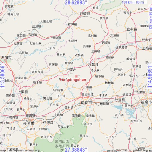
Fengdingshan GPS coordinates[2]
28° 0' 39.492" North, 114° 17' 1.608" East
| Map corner | latitude | longitude |
|---|---|---|
| Upper-left | 28.62993°, | 113.58066° |
| Center: | 28.01097°, | 114.28378° |
| Lower-right: | 27.38843°, | 114.98691° |
| Map W x H: | 138×138 km | = 85.7×85.7mi |
| max Lat: | 53.31946° ⇑74% North |
| Fengdingshan: | 28.01097° |
| min Lat: | ⇓26% South 18.22056° |
| min Long | Fengdingshan | max Long |
| 75.07348° | 114.28378° | 134.28917° |
| W 50.3%⇐ | ⇒49.7% E |
Elevation
Elevation of Fengdingshan is 368 m = 1207 ft, and this is 116.8 m = 383 ft below average elevation for this country.
| Max E: |
5622 m = 18445 ft | 32.5% |
| Avg. | 484.8 m = 1591 ft | |
| Fengdingshan | 368 m = 1207 ft | |
Min E: |
-3 m = -10 ft | 67.5% |
See also: China elevation on elevation.city.
Geographical zone
Fengdingshan is located in North temperate zone (between Tropic of Cancer and the Arctic Circle). Distance of this Northern Tropic circle is 508.6 km =316 mi to South.| Distance of | km | miles | from Fengdingshan |
|---|---|---|---|
| North Pole | 6892.5 | 4282.8 | to North |
| Arctic Circle | 4286.6 | 2663.6 | to North |
| Tropic Cancer | 508.6 | 316 | to South |
| Equator | 3114.5 | 1935.3 | to South |


Nearby cities:
15 places around Fengdingshan: (largest is in red/bold)
• Baimu
14.6 km =9.1 mi,  94°
94°
• Efeng
20 km =12.4 mi,  55°
55°
• Gaocheng
12 km =7.5 mi,  32°
32°
• Hongtang
11.8 km =7.3 mi,  177°
177°
• Jinrui
12.3 km =7.6 mi,  220°
220°
• Kangle
18.8 km =11.7 mi, 60°
• Lingdong
7.3 km =4.5 mi,  325°
325°
• Lucun
19.2 km =11.9 mi,  118°
118°
• Mabu
18.1 km =11.2 mi, 56°
• Nanmu
11.8 km =7.3 mi,  257°
257°
• Sanyang
14.2 km =8.8 mi,  133°
133°
• Shuangqiao
19.4 km =12.1 mi,  8°
8°
• Tanbu
13.5 km =8.4 mi, 330°
• Xintian
20.8 km =12.9 mi,  186°
186°
• Zhutan
13 km =8.1 mi,  290°
290°
Sources, notices
• [Note1] Compared only with cities in China existing in our database
• [Src1] Map data: © OpenStreetMap contributors (CC-BY-SA)
• [Src2] Other city data from geonames.org with taken over terms of usage.
• [Src3] Geographical zone / Annual Mean Temperature by Robert A. Rohde @ Wikipedia
