Jin’an geodata
Jin’an (Sichuan) is a seat of a third-order administrative division; located in China in Asia/Shanghai (GMT+8) time zone. In our database, there are 1268 cities with bigger population. Compared to other cities in China, 64.6% of cities are located further ↓South; 90.8% of cities are located further →East and 96.5% of cities have lower elevation than Jin’an. Note1


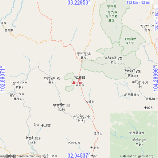
Jin’an GPS coordinates[2]
32° 38' 21.876" North, 103° 35' 48.588" East
| Map corner | latitude | longitude |
|---|---|---|
| Upper-left | 33.22953°, | 102.89371° |
| Center: | 32.63941°, | 103.59683° |
| Lower-right: | 32.04537°, | 104.29996° |
| Map W x H: | 131.7×131.7 km | = 81.8×81.8mi |
| max Lat: | 53.31946° ⇑35.4% North |
| Jin’an: | 32.63941° |
| min Lat: | ⇓64.6% South 18.22056° |
| min Long | Jin’an | max Long |
| 75.07348° | 103.59683° | 134.28917° |
| W 9.2%⇐ | ⇒90.8% E |
Elevation
Elevation of Jin’an is 2851 m = 9354 ft, and this is 2366.2 m = 7763 ft above average elevation for this country.
| Max E: |
5622 m = 18445 ft | 3.5% |
| Jin’an | 2851 m 9354 ft | |
| Avg. | 484.8 m = 1591 ft | |
Min E: |
-3 m = -10 ft | 96.5% |
See also: China elevation on elevation.city.
Geographical zone
Jin’an is located in North temperate zone (between Tropic of Cancer and the Arctic Circle). Distance of this Northern Tropic circle is 1023.2 km =635.8 mi to South.| Distance of | km | miles | from Jin’an |
|---|---|---|---|
| North Pole | 6377.9 | 3963 | to North |
| Arctic Circle | 3772 | 2343.8 | to North |
| Tropic Cancer | 1023.2 | 635.8 | to South |
| Equator | 3629.2 | 2255.1 | to South |


Nearby cities:
15 places around Jin’an: (largest is in red/bold)
• Baoziba
109.2 km =67.9 mi,  63°
63°
• Boyu
115.1 km =71.5 mi,  40°
40°
• Fengyi
108.9 km =67.7 mi,  167°
167°
• Long’an
91 km =56.5 mi,  106°
106°
• Luhua
85.6 km =53.2 mi,  221°
221°
• Maying
94.4 km =58.7 mi,  54°
54°
• Qiongxi
100.1 km =62.2 mi,  279°
279°
• Se’ergu
79.7 km =49.5 mi,  192°
192°
• Shangde
113.6 km =70.6 mi,  74°
74°
• Shifang
99.6 km =61.9 mi, 66°
• Shijiba
93 km =57.8 mi, 59°
• Tielou
86.4 km =53.7 mi, 69°
• Wenxian Chengguanzhen
107 km =66.5 mi, 71°
• Yongle
91.4 km =56.8 mi, 40°
• Zhongzhai
98.3 km =61.1 mi, 51°
Sources, notices
• [Note1] Compared only with cities in China existing in our database
• [Src1] Map data: © OpenStreetMap contributors (CC-BY-SA)
• [Src2] Other city data from geonames.org with taken over terms of usage.
• [Src3] Geographical zone / Annual Mean Temperature by Robert A. Rohde @ Wikipedia
