Se’ergu geodata
Se’ergu (Sichuan) is a seat of a fourth-order administrative division; located in China in Asia/Shanghai (GMT+8) time zone. In our database, there are 1268 cities with bigger population. Compared to other cities in China, 60.8% of cities are located further ↓South; 91% of cities are located further →East and 93.7% of cities have lower elevation than Se’ergu. Note1


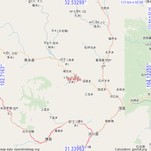
Se’ergu GPS coordinates[2]
31° 56' 17.7" North, 103° 25' 9.912" East
| Map corner | latitude | longitude |
|---|---|---|
| Upper-left | 32.53299°, | 102.7163° |
| Center: | 31.93825°, | 103.41942° |
| Lower-right: | 31.33963°, | 104.12255° |
| Map W x H: | 132.7×132.7 km | = 82.5×82.5mi |
| max Lat: | 53.31946° ⇑39.2% North |
| Se’ergu: | 31.93825° |
| min Lat: | ⇓60.8% South 18.22056° |
| min Long | Se’ergu | max Long |
| 75.07348° | 103.41942° | 134.28917° |
| W 9%⇐ | ⇒91% E |
Elevation
Elevation of Se’ergu is 1809 m = 5935 ft, and this is 1324.2 m = 4344 ft above average elevation for this country.
| Max E: |
5622 m = 18445 ft | 6.3% |
| Se’ergu | 1809 m 5935 ft | |
| Avg. | 484.8 m = 1591 ft | |
Min E: |
-3 m = -10 ft | 93.7% |
See also: China elevation on elevation.city.
Geographical zone
Se’ergu is located in North temperate zone (between Tropic of Cancer and the Arctic Circle). Distance of this Northern Tropic circle is 945.3 km =587.4 mi to South.| Distance of | km | miles | from Se’ergu |
|---|---|---|---|
| North Pole | 6455.9 | 4011.5 | to North |
| Arctic Circle | 3850 | 2392.3 | to North |
| Tropic Cancer | 945.3 | 587.4 | to South |
| Equator | 3551.2 | 2206.6 | to South |


Nearby cities:
15 places around Se’ergu: (largest is in red/bold)
• Barkam
113.2 km =70.3 mi,  267°
267°
• Fangting
114.6 km =71.2 mi,  141°
141°
• Fengyi
49.8 km =30.9 mi,  124°
124°
• Huagai
115.9 km =72 mi,  112°
112°
• Jiangyou
124 km =77.1 mi,  98°
98°
• Jiannan
98.9 km =61.5 mi,  131°
131°
• Jin’an
79.7 km =49.5 mi,  12°
12°
• Long’an
116.8 km =72.6 mi,  63°
63°
• Luhua
43.1 km =26.8 mi,  289°
289°
• Luojiang
124.6 km =77.4 mi, 124°
• Qiongxi
125.7 km =78.1 mi,  319°
319°
• Tianpeng
116.7 km =72.5 mi,  155°
155°
• Weizhou
52 km =32.3 mi, 162°
• Yongchang
100.8 km =62.6 mi, 107°
• Zagunao
59.3 km =36.8 mi,  202°
202°
Sources, notices
• [Note1] Compared only with cities in China existing in our database
• [Src1] Map data: © OpenStreetMap contributors (CC-BY-SA)
• [Src2] Other city data from geonames.org with taken over terms of usage.
• [Src3] Geographical zone / Annual Mean Temperature by Robert A. Rohde @ Wikipedia
