Hubei geodata
Hubei (Shanxi) is a seat of a fourth-order administrative division; located in China in Asia/Shanghai (GMT+8) time zone. In our database, there are 1268 cities with bigger population. Compared to other cities in China, 82.7% of cities are located further ↓South; 62.7% of cities are located further →East and 91.8% of cities have lower elevation than Hubei. Note1


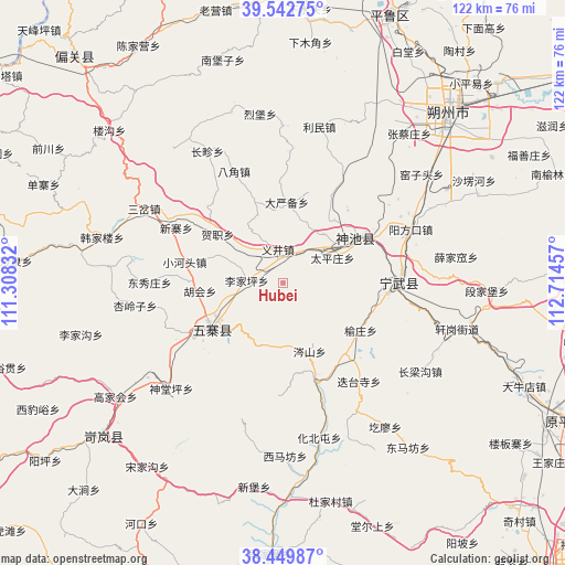
Hubei GPS coordinates[2]
38° 59' 54.312" North, 112° 0' 41.184" East
| Map corner | latitude | longitude |
|---|---|---|
| Upper-left | 39.54275°, | 111.30832° |
| Center: | 38.99842°, | 112.01144° |
| Lower-right: | 38.44987°, | 112.71457° |
| Map W x H: | 121.5×121.5 km | = 75.5×75.5mi |
| max Lat: | 53.31946° ⇑17.3% North |
| Hubei: | 38.99842° |
| min Lat: | ⇓82.7% South 18.22056° |
| min Long | Hubei | max Long |
| 75.07348° | 112.01144° | 134.28917° |
| W 37.3%⇐ | ⇒62.7% E |
Elevation
Elevation of Hubei is 1552 m = 5092 ft, and this is 1067.2 m = 3501 ft above average elevation for this country.
| Max E: |
5622 m = 18445 ft | 8.2% |
| Hubei | 1552 m 5092 ft | |
| Avg. | 484.8 m = 1591 ft | |
Min E: |
-3 m = -10 ft | 91.8% |
See also: China elevation on elevation.city.
Geographical zone
Hubei is located in North temperate zone (between Tropic of Cancer and the Arctic Circle). Distance of this Northern Tropic circle is 1730.3 km =1075.2 mi to South.| Distance of | km | miles | from Hubei |
|---|---|---|---|
| North Pole | 5670.8 | 3523.7 | to North |
| Arctic Circle | 3065 | 1904.5 | to North |
| Tropic Cancer | 1730.3 | 1075.2 | to South |
| Equator | 4336.2 | 2694.4 | to South |


Nearby cities:
15 places around Hubei: (largest is in red/bold)
• Bajiao
26.2 km =16.3 mi,  336°
336°
• Changzhen
32.6 km =20.3 mi,  330°
330°
• Dayanbei
17.5 km =10.9 mi,  2°
2°
• Dietaisi
27.1 km =16.8 mi,  142°
142°
• Donghu
13.8 km =8.6 mi,  39°
39°
• Dongzhai
22.4 km =13.9 mi,  160°
160°
• Fenghuang
24.7 km =15.3 mi,  90°
90°
• Hezhi
17.4 km =10.8 mi,  306°
306°
• Huabeitun
34.2 km =21.3 mi,  166°
166°
• Longquan
18.2 km =11.3 mi,  58°
58°
• Shangyuzhuang
19.6 km =12.2 mi,  121°
121°
• Taipingzhuang
12.1 km =7.5 mi, 62°
• Yancheng
15.4 km =9.6 mi,  233°
233°
• Yangfangkou
29.8 km =18.5 mi,  67°
67°
• Yijing
7.4 km =4.6 mi,  352°
352°
Sources, notices
• [Note1] Compared only with cities in China existing in our database
• [Src1] Map data: © OpenStreetMap contributors (CC-BY-SA)
• [Src2] Other city data from geonames.org with taken over terms of usage.
• [Src3] Geographical zone / Annual Mean Temperature by Robert A. Rohde @ Wikipedia
