Shangyuzhuang geodata
Shangyuzhuang (Shanxi) is a seat of a fourth-order administrative division; located in China in Asia/Shanghai (GMT+8) time zone. In our database, there are 1268 cities with bigger population. Compared to other cities in China, 82.5% of cities are located further ↓South; 61.6% of cities are located further →East and 92.8% of cities have lower elevation than Shangyuzhuang. Note1


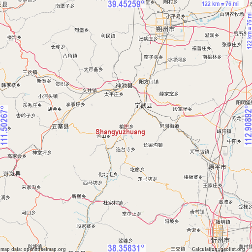
Shangyuzhuang GPS coordinates[2]
38° 54' 27.216" North, 112° 12' 20.844" East
| Map corner | latitude | longitude |
|---|---|---|
| Upper-left | 39.45259°, | 111.50267° |
| Center: | 38.90756°, | 112.20579° |
| Lower-right: | 38.35831°, | 112.90892° |
| Map W x H: | 121.7×121.7 km | = 75.6×75.6mi |
| max Lat: | 53.31946° ⇑17.5% North |
| Shangyuzhuang: | 38.90756° |
| min Lat: | ⇓82.5% South 18.22056° |
| min Long | Shangyuzhuang | max Long |
| 75.07348° | 112.20579° | 134.28917° |
| W 38.4%⇐ | ⇒61.6% E |
Elevation
Elevation of Shangyuzhuang is 1674 m = 5492 ft, and this is 1189.2 m = 3902 ft above average elevation for this country.
| Max E: |
5622 m = 18445 ft | 7.2% |
| Shangyuzhuang | 1674 m 5492 ft | |
| Avg. | 484.8 m = 1591 ft | |
Min E: |
-3 m = -10 ft | 92.8% |
See also: China elevation on elevation.city.
Geographical zone
Shangyuzhuang is located in North temperate zone (between Tropic of Cancer and the Arctic Circle). Distance of this Northern Tropic circle is 1720.2 km =1068.9 mi to South.| Distance of | km | miles | from Shangyuzhuang |
|---|---|---|---|
| North Pole | 5680.9 | 3529.9 | to North |
| Arctic Circle | 3075.1 | 1910.8 | to North |
| Tropic Cancer | 1720.2 | 1068.9 | to South |
| Equator | 4326.1 | 2688.1 | to South |


Nearby cities:
15 places around Shangyuzhuang: (largest is in red/bold)
• Dietaisi
11.3 km =7 mi,  181°
181°
• Donghu
22.2 km =13.8 mi,  338°
338°
• Dongmafang
27.2 km =16.9 mi,  157°
157°
• Dongzhai
14.4 km =8.9 mi,  220°
220°
• Fenghuang
12.8 km =8 mi,  38°
38°
• Huabeitun
24.9 km =15.5 mi,  201°
201°
• Huaidao
25.7 km =16 mi,  173°
173°
• Hubei
19.6 km =12.2 mi,  301°
301°
• Longquan
19.7 km =12.2 mi,  356°
356°
• Taipingzhuang
16.7 km =10.4 mi, 338°
• Ximafang
31.7 km =19.7 mi,  211°
211°
• Xuejiawa
25.9 km =16.1 mi,  52°
52°
• Yancheng
29.1 km =18.1 mi,  271°
271°
• Yangfangkou
24 km =14.9 mi,  26°
26°
• Yijing
24.9 km =15.5 mi,  314°
314°
Sources, notices
• [Note1] Compared only with cities in China existing in our database
• [Src1] Map data: © OpenStreetMap contributors (CC-BY-SA)
• [Src2] Other city data from geonames.org with taken over terms of usage.
• [Src3] Geographical zone / Annual Mean Temperature by Robert A. Rohde @ Wikipedia
