Huangcun geodata
Huangcun (Zhejiang) is a seat of a fourth-order administrative division; located in China in Asia/Shanghai (GMT+8) time zone. In our database, there are 1268 cities with bigger population. Compared to other cities in China, 69.6% of cities are located further ↑North; 82.2% of cities are located further ←West and 54.4% of cities have higher elevation than Huangcun. Note1


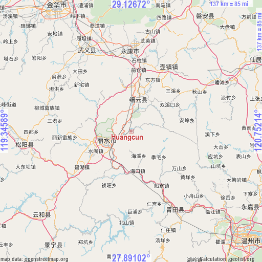
Huangcun GPS coordinates[2]
28° 30' 38.448" North, 120° 2' 56.436" East
| Map corner | latitude | longitude |
|---|---|---|
| Upper-left | 29.12672°, | 119.34589° |
| Center: | 28.51068°, | 120.04901° |
| Lower-right: | 27.89102°, | 120.75214° |
| Map W x H: | 137.4×137.4 km | = 85.4×85.4mi |
| max Lat: | 53.31946° ⇑69.6% North |
| Huangcun: | 28.51068° |
| min Lat: | ⇓30.4% South 18.22056° |
| min Long | Huangcun | max Long |
| 75.07348° | 120.04901° | 134.28917° |
| W 82.2%⇐ | ⇒17.8% E |
Elevation
Elevation of Huangcun is 135 m = 443 ft, and this is 349.8 m = 1148 ft below average elevation for this country.
| Max E: |
5622 m = 18445 ft | 54.4% |
| Avg. | 484.8 m = 1591 ft | |
| Huangcun | 135 m = 443 ft | |
Min E: |
-3 m = -10 ft | 45.6% |
See also: China elevation on elevation.city.
Geographical zone
Huangcun is located in North temperate zone (between Tropic of Cancer and the Arctic Circle). Distance of this Northern Tropic circle is 564.2 km =350.6 mi to South.| Distance of | km | miles | from Huangcun |
|---|---|---|---|
| North Pole | 6837 | 4248.3 | to North |
| Arctic Circle | 4231.1 | 2629.1 | to North |
| Tropic Cancer | 564.2 | 350.6 | to South |
| Equator | 3170.1 | 1969.8 | to South |


Nearby cities:
15 places around Huangcun: (largest is in red/bold)
• Dayang
20.4 km =12.7 mi,  90°
90°
• Dongdu
12.2 km =7.6 mi,  2°
2°
• Fangxi
9.6 km =6 mi,  67°
67°
• Haikou
20.8 km =12.9 mi,  170°
170°
• Haixi
13 km =8.1 mi,  163°
163°
• Huyuan
18.3 km =11.4 mi,  54°
54°
• Liancheng
19.5 km =12.1 mi,  258°
258°
• Lishui
14.7 km =9.1 mi,  247°
247°
• Lizhai
19.7 km =12.2 mi,  132°
132°
• Qili
18.9 km =11.7 mi, 2°
• Shijian
10.1 km =6.3 mi,  107°
107°
• Shuangxi
19.5 km =12.1 mi,  298°
298°
• Shuhong
18.4 km =11.4 mi,  34°
34°
• Shuqiao
9.3 km =5.8 mi, 171°
• Wuyun
16 km =9.9 mi,  6°
6°
Sources, notices
• [Note1] Compared only with cities in China existing in our database
• [Src1] Map data: © OpenStreetMap contributors (CC-BY-SA)
• [Src2] Other city data from geonames.org with taken over terms of usage.
• [Src3] Geographical zone / Annual Mean Temperature by Robert A. Rohde @ Wikipedia
