Dayang geodata
Dayang (Zhejiang) is a seat of a fourth-order administrative division; located in China in Asia/Shanghai (GMT+8) time zone. In our database, there are 1268 cities with bigger population. Compared to other cities in China, 69.7% of cities are located further ↑North; 83.6% of cities are located further ←West and 83.3% of cities have lower elevation than Dayang. Note1


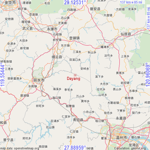
Dayang GPS coordinates[2]
28° 30' 33.336" North, 120° 15' 27.216" East
| Map corner | latitude | longitude |
|---|---|---|
| Upper-left | 29.12531°, | 119.55444° |
| Center: | 28.50926°, | 120.25756° |
| Lower-right: | 27.88959°, | 120.96069° |
| Map W x H: | 137.4×137.4 km | = 85.4×85.4mi |
| max Lat: | 53.31946° ⇑69.7% North |
| Dayang: | 28.50926° |
| min Lat: | ⇓30.3% South 18.22056° |
| min Long | Dayang | max Long |
| 75.07348° | 120.25756° | 134.28917° |
| W 83.6%⇐ | ⇒16.4% E |
Elevation
Elevation of Dayang is 866 m = 2841 ft, and this is 381.2 m = 1251 ft above average elevation for this country.
| Max E: |
5622 m = 18445 ft | 16.7% |
| Dayang | 866 m 2841 ft | |
| Avg. | 484.8 m = 1591 ft | |
Min E: |
-3 m = -10 ft | 83.3% |
See also: China elevation on elevation.city.
Geographical zone
Dayang is located in North temperate zone (between Tropic of Cancer and the Arctic Circle). Distance of this Northern Tropic circle is 564 km =350.5 mi to South.| Distance of | km | miles | from Dayang |
|---|---|---|---|
| North Pole | 6837.1 | 4248.4 | to North |
| Arctic Circle | 4231.2 | 2629.1 | to North |
| Tropic Cancer | 564 | 350.5 | to South |
| Equator | 3169.9 | 1969.7 | to South |


Nearby cities:
15 places around Dayang: (largest is in red/bold)
• Anling
10.7 km =6.6 mi,  55°
55°
• Dayuan
12.7 km =7.9 mi,  28°
28°
• Fangxi
12.1 km =7.5 mi,  288°
288°
• Gaohu
19.6 km =12.2 mi,  191°
191°
• Huyuan
12.1 km =7.5 mi,  333°
333°
• Jiekeng
15.9 km =9.9 mi,  115°
115°
• Lizhai
14.4 km =8.9 mi,  204°
204°
• Muli
10.5 km =6.5 mi,  129°
129°
• Nanxi
5.2 km =3.2 mi,  106°
106°
• Rongjiang
15.1 km =9.4 mi,  347°
347°
• Shijian
11.2 km =7 mi,  254°
254°
• Shuangxikou
14.3 km =8.9 mi,  0°
0°
• Shuhong
18.2 km =11.3 mi, 326°
• Wanshan
19.9 km =12.4 mi,  165°
165°
• Xi’ao
16.3 km =10.1 mi, 126°
Sources, notices
• [Note1] Compared only with cities in China existing in our database
• [Src1] Map data: © OpenStreetMap contributors (CC-BY-SA)
• [Src2] Other city data from geonames.org with taken over terms of usage.
• [Src3] Geographical zone / Annual Mean Temperature by Robert A. Rohde @ Wikipedia
