Hengjiang geodata
Hengjiang (Jiangxi) is a seat of a fourth-order administrative division; located in China in Asia/Shanghai (GMT+8) time zone. In our database, there are 1268 cities with bigger population. Compared to other cities in China, 81.7% of cities are located further ↑North; 62.1% of cities are located further ←West and 57.4% of cities have lower elevation than Hengjiang. Note1


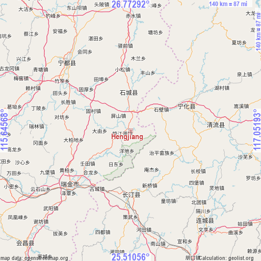
Hengjiang GPS coordinates[2]
26° 8' 36.42" North, 116° 20' 55.68" East
| Map corner | latitude | longitude |
|---|---|---|
| Upper-left | 26.77292°, | 115.64568° |
| Center: | 26.14345°, | 116.3488° |
| Lower-right: | 25.51056°, | 117.05193° |
| Map W x H: | 140.4×140.4 km | = 87.2×87.2mi |
| max Lat: | 53.31946° ⇑81.7% North |
| Hengjiang: | 26.14345° |
| min Lat: | ⇓18.3% South 18.22056° |
| min Long | Hengjiang | max Long |
| 75.07348° | 116.3488° | 134.28917° |
| W 62.1%⇐ | ⇒37.9% E |
Elevation
Elevation of Hengjiang is 229 m = 751 ft, and this is 255.8 m = 839 ft below average elevation for this country.
| Max E: |
5622 m = 18445 ft | 42.6% |
| Avg. | 484.8 m = 1591 ft | |
| Hengjiang | 229 m = 751 ft | |
Min E: |
-3 m = -10 ft | 57.4% |
See also: China elevation on elevation.city.
Geographical zone
Hengjiang is located in North temperate zone (between Tropic of Cancer and the Arctic Circle). Distance of this Northern Tropic circle is 301 km =187 mi to South.| Distance of | km | miles | from Hengjiang |
|---|---|---|---|
| North Pole | 7100.2 | 4411.9 | to North |
| Arctic Circle | 4494.3 | 2792.6 | to North |
| Tropic Cancer | 301 | 187 | to South |
| Equator | 2906.9 | 1806.3 | to South |


Nearby cities:
15 places around Hengjiang: (largest is in red/bold)
• Anjie
23.5 km =14.6 mi,  151°
151°
• Caofang
28.2 km =17.5 mi,  108°
108°
• Dayou
16.6 km =10.3 mi,  270°
270°
• Fangtian
19.6 km =12.2 mi,  76°
76°
• Gucun
22.8 km =14.2 mi,  298°
298°
• Huaitu
13.2 km =8.2 mi,  65°
65°
• Longgang
9.7 km =6 mi,  246°
246°
• Pingshan
10.6 km =6.6 mi,  321°
321°
• Qinjiang
20.8 km =12.9 mi,  356°
356°
• Ridong
19.4 km =12.1 mi,  203°
203°
• Tiechang
24 km =14.9 mi,  168°
168°
• Xinshi
20.2 km =12.6 mi,  54°
54°
• Yangdi
10.7 km =6.6 mi,  191°
191°
• Zhiping Shezu
20.4 km =12.7 mi,  124°
124°
• Zhukeng
8.1 km =5 mi,  8°
8°
Sources, notices
• [Note1] Compared only with cities in China existing in our database
• [Src1] Map data: © OpenStreetMap contributors (CC-BY-SA)
• [Src2] Other city data from geonames.org with taken over terms of usage.
• [Src3] Geographical zone / Annual Mean Temperature by Robert A. Rohde @ Wikipedia
