Xinshi geodata
Xinshi (Fujian) is a seat of a fourth-order administrative division; located in China in Asia/Shanghai (GMT+8) time zone. In our database, there are 1268 cities with bigger population. Compared to other cities in China, 81.3% of cities are located further ↑North; 63.1% of cities are located further ←West and 67% of cities have lower elevation than Xinshi. Note1


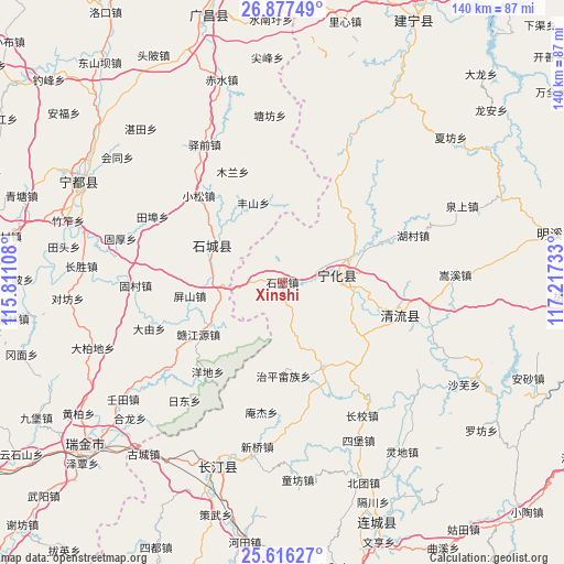
Xinshi GPS coordinates[2]
26° 14' 54.924" North, 116° 30' 51.12" East
| Map corner | latitude | longitude |
|---|---|---|
| Upper-left | 26.87749°, | 115.81108° |
| Center: | 26.24859°, | 116.5142° |
| Lower-right: | 25.61627°, | 117.21733° |
| Map W x H: | 140.2×140.2 km | = 87.1×87.1mi |
| max Lat: | 53.31946° ⇑81.3% North |
| Xinshi: | 26.24859° |
| min Lat: | ⇓18.7% South 18.22056° |
| min Long | Xinshi | max Long |
| 75.07348° | 116.5142° | 134.28917° |
| W 63.1%⇐ | ⇒36.9% E |
Elevation
Elevation of Xinshi is 359 m = 1178 ft, and this is 125.8 m = 413 ft below average elevation for this country.
| Max E: |
5622 m = 18445 ft | 33% |
| Avg. | 484.8 m = 1591 ft | |
| Xinshi | 359 m = 1178 ft | |
Min E: |
-3 m = -10 ft | 67% |
See also: China elevation on elevation.city.
Geographical zone
Xinshi is located in North temperate zone (between Tropic of Cancer and the Arctic Circle). Distance of this Northern Tropic circle is 312.7 km =194.3 mi to South.| Distance of | km | miles | from Xinshi |
|---|---|---|---|
| North Pole | 7088.5 | 4404.6 | to North |
| Arctic Circle | 4482.6 | 2785.4 | to North |
| Tropic Cancer | 312.7 | 194.3 | to South |
| Equator | 2918.6 | 1813.5 | to South |


Nearby cities:
15 places around Xinshi: (largest is in red/bold)
• Caofang
23 km =14.3 mi,  153°
153°
• Chengnan
20.3 km =12.6 mi,  100°
100°
• Cuijiang
13.6 km =8.5 mi,  83°
83°
• Fangtian
7.6 km =4.7 mi,  159°
159°
• Fengshan
21.2 km =13.2 mi,  339°
339°
• Gaotian
25.1 km =15.6 mi,  349°
349°
• Helong
26 km =16.2 mi,  32°
32°
• Hengjiang
20.2 km =12.6 mi,  234°
234°
• Huaitu
7.7 km =4.8 mi,  215°
215°
• Pingshan
23.3 km =14.5 mi,  261°
261°
• Qinjiang
20.1 km =12.5 mi,  296°
296°
• Xianan
14.6 km =9.1 mi, 82°
• Xinji
10.8 km =6.7 mi,  22°
22°
• Zhiping Shezu
23.3 km =14.5 mi,  179°
179°
• Zhukeng
15.7 km =9.8 mi, 256°
Sources, notices
• [Note1] Compared only with cities in China existing in our database
• [Src1] Map data: © OpenStreetMap contributors (CC-BY-SA)
• [Src2] Other city data from geonames.org with taken over terms of usage.
• [Src3] Geographical zone / Annual Mean Temperature by Robert A. Rohde @ Wikipedia
