Hejiaping geodata
Hejiaping (Hubei) is a seat of a fourth-order administrative division; located in China in Asia/Shanghai (GMT+8) time zone. In our database, there are 1268 cities with bigger population. Compared to other cities in China, 51.2% of cities are located further ↓South; 67.8% of cities are located further →East and 81% of cities have lower elevation than Hejiaping. Note1


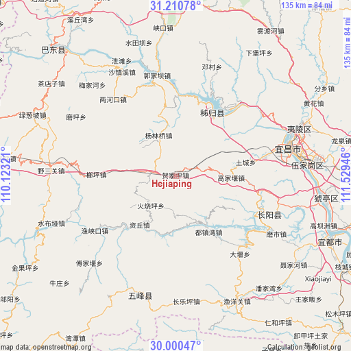
Hejiaping GPS coordinates[2]
30° 36' 27.072" North, 110° 49' 34.788" East
| Map corner | latitude | longitude |
|---|---|---|
| Upper-left | 31.21078°, | 110.12321° |
| Center: | 30.60752°, | 110.82633° |
| Lower-right: | 30.00047°, | 111.52946° |
| Map W x H: | 134.6×134.6 km | = 83.6×83.6mi |
| max Lat: | 53.31946° ⇑48.8% North |
| Hejiaping: | 30.60752° |
| min Lat: | ⇓51.2% South 18.22056° |
| min Long | Hejiaping | max Long |
| 75.07348° | 110.82633° | 134.28917° |
| W 32.2%⇐ | ⇒67.8% E |
Elevation
Elevation of Hejiaping is 744 m = 2441 ft, and this is 259.2 m = 850 ft above average elevation for this country.
| Max E: |
5622 m = 18445 ft | 19% |
| Hejiaping | 744 m 2441 ft | |
| Avg. | 484.8 m = 1591 ft | |
Min E: |
-3 m = -10 ft | 81% |
See also: China elevation on elevation.city.
Geographical zone
Hejiaping is located in North temperate zone (between Tropic of Cancer and the Arctic Circle). Distance of this Northern Tropic circle is 797.3 km =495.4 mi to South.| Distance of | km | miles | from Hejiaping |
|---|---|---|---|
| North Pole | 6603.8 | 4103.4 | to North |
| Arctic Circle | 3997.9 | 2484.2 | to North |
| Tropic Cancer | 797.3 | 495.4 | to South |
| Equator | 3403.2 | 2114.6 | to South |


Nearby cities:
15 places around Hejiaping: (largest is in red/bold)
• Duzhenwan
24.9 km =15.5 mi,  149°
149°
• Gaojiayan
22 km =13.7 mi,  89°
89°
• Guojiaba
36.2 km =22.5 mi,  345°
345°
• Huoshaoping
14.6 km =9.1 mi,  220°
220°
• Langping
30.5 km =19 mi,  271°
271°
• Longzhouping
34.3 km =21.3 mi,  111°
111°
• Maoping
28.6 km =17.8 mi,  30°
30°
• Qiaobian
35.5 km =22.1 mi,  76°
76°
• Sandouping
29 km =18 mi,  38°
38°
• Taipingxi
32.6 km =20.3 mi,  23°
23°
• Tucheng
27.3 km =17 mi, 78°
• Yanglinqiao
17 km =10.6 mi,  337°
337°
• Yazikou
20.4 km =12.7 mi, 151°
• Zhouping
26.6 km =16.5 mi, 350°
• Ziqiu
23.7 km =14.7 mi, 216°
Sources, notices
• [Note1] Compared only with cities in China existing in our database
• [Src1] Map data: © OpenStreetMap contributors (CC-BY-SA)
• [Src2] Other city data from geonames.org with taken over terms of usage.
• [Src3] Geographical zone / Annual Mean Temperature by Robert A. Rohde @ Wikipedia
