Hanfang geodata
Hanfang (Jiangxi) is a seat of a fourth-order administrative division; located in China in Asia/Shanghai (GMT+8) time zone. In our database, there are 1268 cities with bigger population. Compared to other cities in China, 84.3% of cities are located further ↑North; 54.8% of cities are located further ←West and 52.9% of cities have lower elevation than Hanfang. Note1


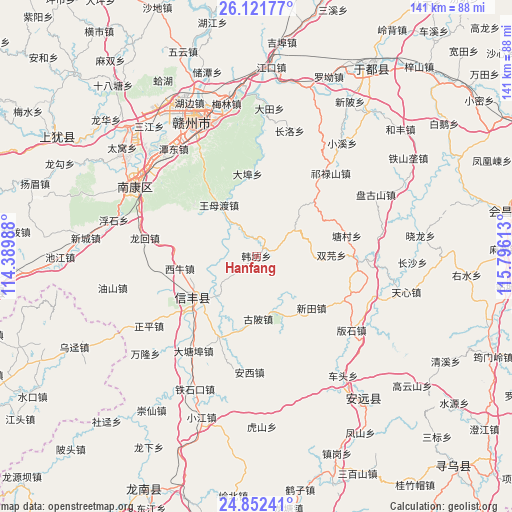
Hanfang GPS coordinates[2]
25° 29' 19.572" North, 115° 5' 34.8" East
| Map corner | latitude | longitude |
|---|---|---|
| Upper-left | 26.12177°, | 114.38988° |
| Center: | 25.48877°, | 115.093° |
| Lower-right: | 24.85241°, | 115.79613° |
| Map W x H: | 141.1×141.1 km | = 87.7×87.7mi |
| max Lat: | 53.31946° ⇑84.3% North |
| Hanfang: | 25.48877° |
| min Lat: | ⇓15.7% South 18.22056° |
| min Long | Hanfang | max Long |
| 75.07348° | 115.093° | 134.28917° |
| W 54.8%⇐ | ⇒45.2% E |
Elevation
Elevation of Hanfang is 188 m = 617 ft, and this is 296.8 m = 974 ft below average elevation for this country.
| Max E: |
5622 m = 18445 ft | 47.1% |
| Avg. | 484.8 m = 1591 ft | |
| Hanfang | 188 m = 617 ft | |
Min E: |
-3 m = -10 ft | 52.9% |
See also: China elevation on elevation.city.
Geographical zone
Hanfang is located in North temperate zone (between Tropic of Cancer and the Arctic Circle). Distance of this Northern Tropic circle is 228.2 km =141.8 mi to South.| Distance of | km | miles | from Hanfang |
|---|---|---|---|
| North Pole | 7173 | 4457.1 | to North |
| Arctic Circle | 4567.1 | 2837.9 | to North |
| Tropic Cancer | 228.2 | 141.8 | to South |
| Equator | 2834.1 | 1761 | to South |


Nearby cities:
15 places around Hanfang: (largest is in red/bold)
• Anxi
31.9 km =19.8 mi,  183°
183°
• Banshi
33.2 km =20.6 mi,  127°
127°
• Changluo
36.2 km =22.5 mi,  14°
14°
• Dabu
22.8 km =14.2 mi,  354°
354°
• Daqiao
16.2 km =10.1 mi,  160°
160°
• Fucha
34.5 km =21.4 mi,  80°
80°
• Gubei
17.2 km =10.7 mi, 178°
• Jiading
17.8 km =11.1 mi,  248°
248°
• Longbu
28.5 km =17.7 mi,  93°
93°
• Qilushan
30.9 km =19.2 mi,  41°
41°
• Shuangyuan
20.8 km =12.9 mi, 88°
• Tangcun
25.7 km =16 mi, 77°
• Wangmudu
16.7 km =10.4 mi,  324°
324°
• Xintian
20.8 km =12.9 mi, 132°
• Zhongshi
34.4 km =21.4 mi,  109°
109°
Sources, notices
• [Note1] Compared only with cities in China existing in our database
• [Src1] Map data: © OpenStreetMap contributors (CC-BY-SA)
• [Src2] Other city data from geonames.org with taken over terms of usage.
• [Src3] Geographical zone / Annual Mean Temperature by Robert A. Rohde @ Wikipedia
