Haiyangsuo geodata
Haiyangsuo (Shandong) is a seat of a fourth-order administrative division; located in China in Asia/Shanghai (GMT+8) time zone. In our database, there are 1268 cities with bigger population. Compared to other cities in China, 78.7% of cities are located further ↓South; 90.4% of cities are located further ←West and 83.9% of cities have higher elevation than Haiyangsuo. Note1


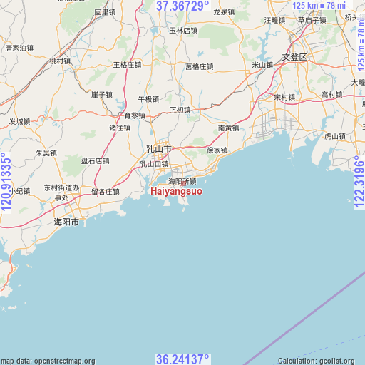
Haiyangsuo GPS coordinates[2]
36° 48' 23.04" North, 121° 36' 59.292" East
| Map corner | latitude | longitude |
|---|---|---|
| Upper-left | 37.36729°, | 120.91335° |
| Center: | 36.8064°, | 121.61647° |
| Lower-right: | 36.24137°, | 122.3196° |
| Map W x H: | 125.2×125.2 km | = 77.8×77.8mi |
| max Lat: | 53.31946° ⇑21.3% North |
| Haiyangsuo: | 36.8064° |
| min Lat: | ⇓78.7% South 18.22056° |
| min Long | Haiyangsuo | max Long |
| 75.07348° | 121.61647° | 134.28917° |
| W 90.4%⇐ | ⇒9.6% E |
Elevation
Elevation of Haiyangsuo is 18 m = 59 ft, and this is 466.8 m = 1531 ft below average elevation for this country.
| Max E: |
5622 m = 18445 ft | 83.9% |
| Avg. | 484.8 m = 1591 ft | |
| Haiyangsuo | 18 m = 59 ft | |
Min E: |
-3 m = -10 ft | 16.1% |
See also: China elevation on elevation.city.
Geographical zone
Haiyangsuo is located in North temperate zone (between Tropic of Cancer and the Arctic Circle). Distance of this Northern Tropic circle is 1486.6 km =923.7 mi to South.| Distance of | km | miles | from Haiyangsuo |
|---|---|---|---|
| North Pole | 5914.6 | 3675.2 | to North |
| Arctic Circle | 3308.7 | 2055.9 | to North |
| Tropic Cancer | 1486.6 | 923.7 | to South |
| Equator | 4092.5 | 2543 | to South |


Nearby cities:
15 places around Haiyangsuo: (largest is in red/bold)
• Baishatan
7.6 km =4.7 mi,  67°
67°
• Chengqu
14.2 km =8.8 mi,  324°
324°
• Dagushan
12.4 km =7.7 mi,  4°
4°
• Dongcun
40.8 km =25.4 mi,  265°
265°
• Fengjia
25.8 km =16 mi,  10°
10°
• Jugezhuang
40.5 km =25.2 mi, 8°
• Nanhuang
24.7 km =15.3 mi,  39°
39°
• Rushankou
11.7 km =7.3 mi,  303°
303°
• Rushanzhai
17.5 km =10.9 mi, 299°
• Shuidao
40.7 km =25.3 mi,  355°
355°
• Wuji
31.2 km =19.4 mi,  337°
337°
• Xiachu
25.2 km =15.7 mi, 358°
• Xiaoguan
29.5 km =18.3 mi,  50°
50°
• Xujia
16.4 km =10.2 mi, 46°
• Zetou
36.2 km =22.5 mi, 41°
Sources, notices
• [Note1] Compared only with cities in China existing in our database
• [Src1] Map data: © OpenStreetMap contributors (CC-BY-SA)
• [Src2] Other city data from geonames.org with taken over terms of usage.
• [Src3] Geographical zone / Annual Mean Temperature by Robert A. Rohde @ Wikipedia
