Guandu geodata
Guandu (Hubei) is a seat of a fourth-order administrative division; located in China in Asia/Shanghai (GMT+8) time zone. In our database, there are 1268 cities with bigger population. Compared to other cities in China, 61.1% of cities are located further ↓South; 70.9% of cities are located further →East and 67.1% of cities have lower elevation than Guandu. Note1


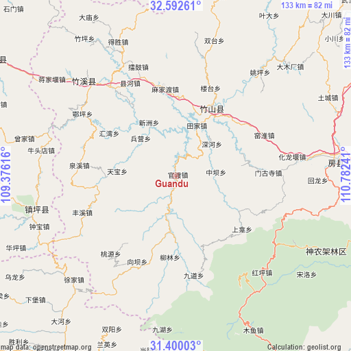
Guandu GPS coordinates[2]
31° 59' 53.736" North, 110° 4' 45.408" East
| Map corner | latitude | longitude |
|---|---|---|
| Upper-left | 32.59261°, | 109.37616° |
| Center: | 31.99826°, | 110.07928° |
| Lower-right: | 31.40003°, | 110.78241° |
| Map W x H: | 132.6×132.6 km | = 82.4×82.4mi |
| max Lat: | 53.31946° ⇑38.9% North |
| Guandu: | 31.99826° |
| min Lat: | ⇓61.1% South 18.22056° |
| min Long | Guandu | max Long |
| 75.07348° | 110.07928° | 134.28917° |
| W 29.1%⇐ | ⇒70.9% E |
Elevation
Elevation of Guandu is 360 m = 1181 ft, and this is 124.8 m = 409 ft below average elevation for this country.
| Max E: |
5622 m = 18445 ft | 32.9% |
| Avg. | 484.8 m = 1591 ft | |
| Guandu | 360 m = 1181 ft | |
Min E: |
-3 m = -10 ft | 67.1% |
See also: China elevation on elevation.city.
Geographical zone
Guandu is located in North temperate zone (between Tropic of Cancer and the Arctic Circle). Distance of this Northern Tropic circle is 952 km =591.5 mi to South.| Distance of | km | miles | from Guandu |
|---|---|---|---|
| North Pole | 6449.2 | 4007.3 | to North |
| Arctic Circle | 3843.3 | 2388.1 | to North |
| Tropic Cancer | 952 | 591.5 | to South |
| Equator | 3557.9 | 2210.8 | to South |


Nearby cities:
15 places around Guandu: (largest is in red/bold)
• Baofeng
34.5 km =21.4 mi,  348°
348°
• Bingying
18 km =11.2 mi,  313°
313°
• Fengxi
38.1 km =23.7 mi,  248°
248°
• Huiwan
29.4 km =18.3 mi,  302°
302°
• Majiadu
33.4 km =20.8 mi, 352°
• Mengusi
35 km =21.7 mi,  88°
88°
• Quanxi
36.9 km =22.9 mi,  276°
276°
• Taoyuan
38.1 km =23.7 mi,  220°
220°
• Tianbao
22.3 km =13.9 mi,  274°
274°
• Tianjiaba
20.3 km =12.6 mi,  17°
17°
• Xiangba
35.6 km =22.1 mi,  204°
204°
• Xianhe
31.3 km =19.4 mi,  328°
328°
• Xinzhou
22.7 km =14.1 mi, 332°
• Yishui
30 km =18.6 mi,  2°
2°
• Zhushan Chengguanzhen
28.9 km =18 mi,  30°
30°
Sources, notices
• [Note1] Compared only with cities in China existing in our database
• [Src1] Map data: © OpenStreetMap contributors (CC-BY-SA)
• [Src2] Other city data from geonames.org with taken over terms of usage.
• [Src3] Geographical zone / Annual Mean Temperature by Robert A. Rohde @ Wikipedia
