Xiangba geodata
Xiangba (Hubei) is a seat of a fourth-order administrative division; located in China in Asia/Shanghai (GMT+8) time zone. In our database, there are 1268 cities with bigger population. Compared to other cities in China, 59.5% of cities are located further ↓South; 71.7% of cities are located further →East and 83.4% of cities have lower elevation than Xiangba. Note1


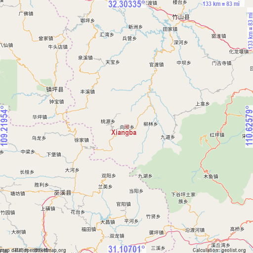
Xiangba GPS coordinates[2]
31° 42' 25.596" North, 109° 55' 21.576" East
| Map corner | latitude | longitude |
|---|---|---|
| Upper-left | 32.30335°, | 109.21954° |
| Center: | 31.70711°, | 109.92266° |
| Lower-right: | 31.10701°, | 110.62579° |
| Map W x H: | 133×133 km | = 82.6×82.6mi |
| max Lat: | 53.31946° ⇑40.5% North |
| Xiangba: | 31.70711° |
| min Lat: | ⇓59.5% South 18.22056° |
| min Long | Xiangba | max Long |
| 75.07348° | 109.92266° | 134.28917° |
| W 28.3%⇐ | ⇒71.7% E |
Elevation
Elevation of Xiangba is 876 m = 2874 ft, and this is 391.2 m = 1283 ft above average elevation for this country.
| Max E: |
5622 m = 18445 ft | 16.6% |
| Xiangba | 876 m 2874 ft | |
| Avg. | 484.8 m = 1591 ft | |
Min E: |
-3 m = -10 ft | 83.4% |
See also: China elevation on elevation.city.
Geographical zone
Xiangba is located in North temperate zone (between Tropic of Cancer and the Arctic Circle). Distance of this Northern Tropic circle is 919.6 km =571.4 mi to South.| Distance of | km | miles | from Xiangba |
|---|---|---|---|
| North Pole | 6481.6 | 4027.5 | to North |
| Arctic Circle | 3875.7 | 2408.2 | to North |
| Tropic Cancer | 919.6 | 571.4 | to South |
| Equator | 3525.5 | 2190.6 | to South |


Nearby cities:
15 places around Xiangba: (largest is in red/bold)
• Bailu
25.8 km =16 mi,  246°
246°
• Dadong
36.7 km =22.8 mi,  231°
231°
• Dangyang
33.9 km =21.1 mi,  171°
171°
• Fengxi
28 km =17.4 mi,  311°
311°
• Guandu
35.6 km =22.1 mi,  24°
24°
• Guanyang
40.6 km =25.2 mi,  182°
182°
• Jiuhu
31.8 km =19.8 mi,  148°
148°
• Miaotang
42 km =26.1 mi,  156°
156°
• Ningchang
36.6 km =22.7 mi, 226°
• Shuangyang
27.3 km =17 mi,  200°
200°
• Taoyuan
10.4 km =6.5 mi,  288°
288°
• Tianbao
35 km =21.7 mi,  347°
347°
• Tongcheng
38.8 km =24.1 mi,  207°
207°
• Xujia
24.8 km =15.4 mi, 253°
• Yulin
41.4 km =25.7 mi,  265°
265°
Sources, notices
• [Note1] Compared only with cities in China existing in our database
• [Src1] Map data: © OpenStreetMap contributors (CC-BY-SA)
• [Src2] Other city data from geonames.org with taken over terms of usage.
• [Src3] Geographical zone / Annual Mean Temperature by Robert A. Rohde @ Wikipedia
