Fengxi geodata
Fengxi (Hubei) is a seat of a fourth-order administrative division; located in China in Asia/Shanghai (GMT+8) time zone. In our database, there are 1268 cities with bigger population. Compared to other cities in China, 60.5% of cities are located further ↓South; 72.8% of cities are located further →East and 82% of cities have lower elevation than Fengxi. Note1


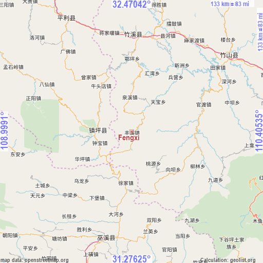
Fengxi GPS coordinates[2]
31° 52' 30.972" North, 109° 42' 7.992" East
| Map corner | latitude | longitude |
|---|---|---|
| Upper-left | 32.47042°, | 108.9991° |
| Center: | 31.87527°, | 109.70222° |
| Lower-right: | 31.27625°, | 110.40535° |
| Map W x H: | 132.8×132.8 km | = 82.5×82.5mi |
| max Lat: | 53.31946° ⇑39.5% North |
| Fengxi: | 31.87527° |
| min Lat: | ⇓60.5% South 18.22056° |
| min Long | Fengxi | max Long |
| 75.07348° | 109.70222° | 134.28917° |
| W 27.2%⇐ | ⇒72.8% E |
Elevation
Elevation of Fengxi is 790 m = 2592 ft, and this is 305.2 m = 1001 ft above average elevation for this country.
| Max E: |
5622 m = 18445 ft | 18% |
| Fengxi | 790 m 2592 ft | |
| Avg. | 484.8 m = 1591 ft | |
Min E: |
-3 m = -10 ft | 82% |
See also: China elevation on elevation.city.
Geographical zone
Fengxi is located in North temperate zone (between Tropic of Cancer and the Arctic Circle). Distance of this Northern Tropic circle is 938.3 km =583 mi to South.| Distance of | km | miles | from Fengxi |
|---|---|---|---|
| North Pole | 6462.9 | 4015.9 | to North |
| Arctic Circle | 3857 | 2396.6 | to North |
| Tropic Cancer | 938.3 | 583 | to South |
| Equator | 3544.2 | 2202.3 | to South |


Nearby cities:
15 places around Fengxi: (largest is in red/bold)
• Bailu
29.3 km =18.2 mi,  185°
185°
• Bingying
34.5 km =21.4 mi,  40°
40°
• Dadong
42.2 km =26.2 mi, 190°
• Eping
36 km =22.4 mi,  355°
355°
• Guandu
38.1 km =23.7 mi,  68°
68°
• Huiwan
31.4 km =19.5 mi,  19°
19°
• Ningchang
44.1 km =27.4 mi, 187°
• Quanxi
17.7 km =11 mi, 356°
• Taoyuan
19 km =11.8 mi,  144°
144°
• Tianbao
20.4 km =12.7 mi, 40°
• Wulong
35.5 km =22.1 mi,  226°
226°
• Xiangba
28 km =17.4 mi,  131°
131°
• Xinzhou
42 km =26.1 mi, 36°
• Xujia
25.8 km =16 mi, 186°
• Yulin
30.2 km =18.8 mi,  222°
222°
Sources, notices
• [Note1] Compared only with cities in China existing in our database
• [Src1] Map data: © OpenStreetMap contributors (CC-BY-SA)
• [Src2] Other city data from geonames.org with taken over terms of usage.
• [Src3] Geographical zone / Annual Mean Temperature by Robert A. Rohde @ Wikipedia
