Gaotang geodata
Gaotang (Shaanxi) is a seat of a fourth-order administrative division; located in China in Asia/Shanghai (GMT+8) time zone. In our database, there are 1268 cities with bigger population. Compared to other cities in China, 72.2% of cities are located further ↓South; 73% of cities are located further →East and 76.4% of cities have lower elevation than Gaotang. Note1


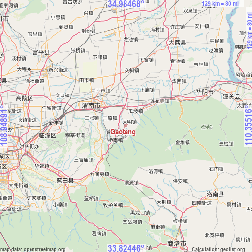
Gaotang GPS coordinates[2]
34° 24' 23.688" North, 109° 39' 7.308" East
| Map corner | latitude | longitude |
|---|---|---|
| Upper-left | 34.98468°, | 108.94891° |
| Center: | 34.40658°, | 109.65203° |
| Lower-right: | 33.82446°, | 110.35516° |
| Map W x H: | 129×129 km | = 80.2×80.2mi |
| max Lat: | 53.31946° ⇑27.8% North |
| Gaotang: | 34.40658° |
| min Lat: | ⇓72.2% South 18.22056° |
| min Long | Gaotang | max Long |
| 75.07348° | 109.65203° | 134.28917° |
| W 27%⇐ | ⇒73% E |
Elevation
Elevation of Gaotang is 559 m = 1834 ft, and this is 74.2 m = 243 ft above average elevation for this country.
| Max E: |
5622 m = 18445 ft | 23.6% |
| Gaotang | 559 m 1834 ft | |
| Avg. | 484.8 m = 1591 ft | |
Min E: |
-3 m = -10 ft | 76.4% |
See also: China elevation on elevation.city.
Geographical zone
Gaotang is located in North temperate zone (between Tropic of Cancer and the Arctic Circle). Distance of this Northern Tropic circle is 1219.7 km =757.9 mi to South.| Distance of | km | miles | from Gaotang |
|---|---|---|---|
| North Pole | 6181.4 | 3840.9 | to North |
| Arctic Circle | 3575.5 | 2221.7 | to North |
| Tropic Cancer | 1219.7 | 757.9 | to South |
| Equator | 3825.7 | 2377.2 | to South |


Nearby cities:
15 places around Gaotang: (largest is in red/bold)
• Chishui
11.2 km =7 mi,  355°
355°
• Chongning
6.6 km =4.1 mi,  245°
245°
• Daming
3.1 km =1.9 mi,  36°
36°
• Dongyang
3.3 km =2.1 mi,  222°
222°
• Fengyuan
9.2 km =5.7 mi,  298°
298°
• Guapo
9.3 km =5.8 mi,  32°
32°
• Hexi
11.7 km =7.3 mi,  272°
272°
• Huazhou
15.5 km =9.6 mi, 38°
• Jinhui
5.2 km =3.2 mi,  58°
58°
• Longbei
16.9 km =10.5 mi,  334°
334°
• Qiaonan
8.9 km =5.5 mi, 217°
• Weinan
17 km =10.6 mi,  309°
309°
• Xinglin
13.9 km =8.6 mi,  45°
45°
• Yancun
14.5 km =9 mi,  275°
275°
• Yangguo
13.4 km =8.3 mi, 245°
Sources, notices
• [Note1] Compared only with cities in China existing in our database
• [Src1] Map data: © OpenStreetMap contributors (CC-BY-SA)
• [Src2] Other city data from geonames.org with taken over terms of usage.
• [Src3] Geographical zone / Annual Mean Temperature by Robert A. Rohde @ Wikipedia
