Ganxi geodata
Ganxi (Guizhou) is a seat of a fourth-order administrative division; located in China in Asia/Shanghai (GMT+8) time zone. In our database, there are 1268 cities with bigger population. Compared to other cities in China, 70.7% of cities are located further ↑North; 78.9% of cities are located further →East and 72.2% of cities have lower elevation than Ganxi. Note1


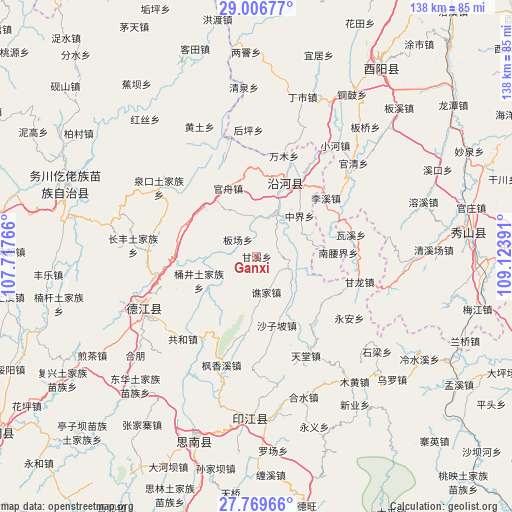
Ganxi GPS coordinates[2]
28° 23' 24.072" North, 108° 25' 14.808" East
| Map corner | latitude | longitude |
|---|---|---|
| Upper-left | 29.00677°, | 107.71766° |
| Center: | 28.39002°, | 108.42078° |
| Lower-right: | 27.76966°, | 109.12391° |
| Map W x H: | 137.6×137.6 km | = 85.5×85.5mi |
| max Lat: | 53.31946° ⇑70.7% North |
| Ganxi: | 28.39002° |
| min Lat: | ⇓29.3% South 18.22056° |
| min Long | Ganxi | max Long |
| 75.07348° | 108.42078° | 134.28917° |
| W 21.1%⇐ | ⇒78.9% E |
Elevation
Elevation of Ganxi is 458 m = 1503 ft, and this is 26.8 m = 88 ft below average elevation for this country.
| Max E: |
5622 m = 18445 ft | 27.8% |
| Avg. | 484.8 m = 1591 ft | |
| Ganxi | 458 m = 1503 ft | |
Min E: |
-3 m = -10 ft | 72.2% |
See also: China elevation on elevation.city.
Geographical zone
Ganxi is located in North temperate zone (between Tropic of Cancer and the Arctic Circle). Distance of this Northern Tropic circle is 550.8 km =342.3 mi to South.| Distance of | km | miles | from Ganxi |
|---|---|---|---|
| North Pole | 6850.4 | 4256.6 | to North |
| Arctic Circle | 4244.5 | 2637.4 | to North |
| Tropic Cancer | 550.8 | 342.3 | to South |
| Equator | 3156.7 | 1961.5 | to South |


Nearby cities:
15 places around Ganxi: (largest is in red/bold)
• Banchang
6.8 km =4.2 mi,  312°
312°
• Guanzhou
19.9 km =12.4 mi,  337°
337°
• Heishui
22.8 km =14.2 mi,  4°
4°
• Heping
19.9 km =12.4 mi,  19°
19°
• Jiashi
10.8 km =6.7 mi,  234°
234°
• Nanyaojie
21.9 km =13.6 mi,  87°
87°
• Qiaojia
10 km =6.2 mi,  165°
165°
• Qitan
10.6 km =6.6 mi, 18°
• Shazi
21.2 km =13.2 mi,  33°
33°
• Shazipo
19.3 km =12 mi,  163°
163°
• Tongjing
16.4 km =10.2 mi,  248°
248°
• Tudi’ao
21.8 km =13.5 mi,  291°
291°
• Wenping
21.6 km =13.4 mi, 246°
• Xiaojing
15.8 km =9.8 mi,  73°
73°
• Zhongjie
14.6 km =9.1 mi,  55°
55°
Sources, notices
• [Note1] Compared only with cities in China existing in our database
• [Src1] Map data: © OpenStreetMap contributors (CC-BY-SA)
• [Src2] Other city data from geonames.org with taken over terms of usage.
• [Src3] Geographical zone / Annual Mean Temperature by Robert A. Rohde @ Wikipedia
