Futian geodata
Futian (Jiangxi) is a seat of a fourth-order administrative division; located in China in Asia/Shanghai (GMT+8) time zone. In our database, there are 1268 cities with bigger population. Compared to other cities in China, 76.9% of cities are located further ↑North; 53.8% of cities are located further ←West and 70.8% of cities have higher elevation than Futian. Note1


Futian GPS coordinates[2]
27° 25' 44.292" North, 114° 55' 37.56" East
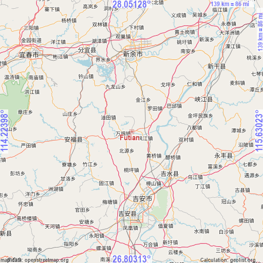
| Map corner | latitude | longitude |
|---|---|---|
| Upper-left | 28.05128°, | 114.22398° |
| Center: | 27.42897°, | 114.9271° |
| Lower-right: | 26.80313°, | 115.63023° |
| Map W x H: | 138.8×138.8 km | = 86.2×86.2mi |
| max Lat: | 53.31946° ⇑76.9% North |
| Futian: | 27.42897° |
| min Lat: | ⇓23.1% South 18.22056° |
| min Long | Futian | max Long |
| 75.07348° | 114.9271° | 134.28917° |
| W 53.8%⇐ | ⇒46.2% E |
Elevation
Elevation of Futian is 49 m = 161 ft, and this is 435.8 m = 1430 ft below average elevation for this country.
| Max E: |
5622 m = 18445 ft | 70.8% |
| Avg. | 484.8 m = 1591 ft | |
| Futian | 49 m = 161 ft | |
Min E: |
-3 m = -10 ft | 29.2% |
See also: China elevation on elevation.city.
Geographical zone
Futian is located in North temperate zone (between Tropic of Cancer and the Arctic Circle). Distance of this Northern Tropic circle is 443.9 km =275.8 mi to South.| Distance of | km | miles | from Futian |
|---|---|---|---|
| North Pole | 6957.2 | 4323 | to North |
| Arctic Circle | 4351.4 | 2703.8 | to North |
| Tropic Cancer | 443.9 | 275.8 | to South |
| Equator | 3049.8 | 1895.1 | to South |


Nearby cities:
15 places around Futian: (largest is in red/bold)
• Dachong
13.2 km =8.2 mi,  217°
217°
• Fengjiang
8 km =5 mi,  113°
113°
• Fengtian
23.7 km =14.7 mi,  254°
254°
• Guashe
20.5 km =12.7 mi,  264°
264°
• Huangqiao
17 km =10.6 mi,  137°
137°
• Jinjiang
18.3 km =11.4 mi,  18°
18°
• Jiulongshan
25.6 km =15.9 mi,  340°
340°
• Laoqiao
25.5 km =15.8 mi,  123°
123°
• Luotian
17.3 km =10.7 mi,  44°
44°
• Pangu
7.9 km =4.9 mi,  87°
87°
• Shangxian
8.3 km =5.2 mi,  156°
156°
• Shuitian
21.8 km =13.5 mi, 92°
• Tongping
19.9 km =12.4 mi,  180°
180°
• Wanfu
4.8 km =3 mi, 246°
• Youtian
16.2 km =10.1 mi,  304°
304°
Sources, notices
• [Note1] Compared only with cities in China existing in our database
• [Src1] Map data: © OpenStreetMap contributors (CC-BY-SA)
• [Src2] Other city data from geonames.org with taken over terms of usage.
• [Src3] Geographical zone / Annual Mean Temperature by Robert A. Rohde @ Wikipedia
