Fushui geodata
Fushui (Shaanxi) is a seat of a fourth-order administrative division; located in China in Asia/Shanghai (GMT+8) time zone. In our database, there are 1268 cities with bigger population. Compared to other cities in China, 73% of cities are located further ↓South; 71.5% of cities are located further →East and 66% of cities have lower elevation than Fushui. Note1


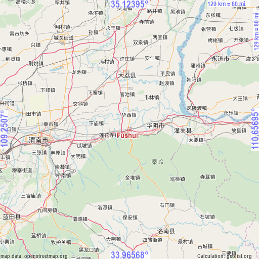
Fushui GPS coordinates[2]
34° 32' 48.588" North, 109° 57' 13.752" East
| Map corner | latitude | longitude |
|---|---|---|
| Upper-left | 35.12395°, | 109.2507° |
| Center: | 34.54683°, | 109.95382° |
| Lower-right: | 33.96568°, | 110.65695° |
| Map W x H: | 128.8×128.8 km | = 80×80mi |
| max Lat: | 53.31946° ⇑27% North |
| Fushui: | 34.54683° |
| min Lat: | ⇓73% South 18.22056° |
| min Long | Fushui | max Long |
| 75.07348° | 109.95382° | 134.28917° |
| W 28.5%⇐ | ⇒71.5% E |
Elevation
Elevation of Fushui is 343 m = 1125 ft, and this is 141.8 m = 465 ft below average elevation for this country.
| Max E: |
5622 m = 18445 ft | 34% |
| Avg. | 484.8 m = 1591 ft | |
| Fushui | 343 m = 1125 ft | |
Min E: |
-3 m = -10 ft | 66% |
See also: China elevation on elevation.city.
Geographical zone
Fushui is located in North temperate zone (between Tropic of Cancer and the Arctic Circle). Distance of this Northern Tropic circle is 1235.3 km =767.6 mi to South.| Distance of | km | miles | from Fushui |
|---|---|---|---|
| North Pole | 6165.8 | 3831.2 | to North |
| Arctic Circle | 3559.9 | 2212 | to North |
| Tropic Cancer | 1235.3 | 767.6 | to South |
| Equator | 3841.2 | 2386.8 | to South |


Nearby cities:
15 places around Fushui: (largest is in red/bold)
• Bijia
11.3 km =7 mi,  290°
290°
• Guanchi
17.4 km =10.8 mi,  355°
355°
• Huayang
15.1 km =9.4 mi,  165°
165°
• Huayin
10.5 km =6.5 mi,  78°
78°
• Huazhou
18.3 km =11.4 mi,  258°
258°
• Jindui
23.7 km =14.7 mi,  176°
176°
• Lianhuasi
10.6 km =6.6 mi, 256°
• Liuzhi
8.9 km =5.5 mi, 264°
• Shicao
22.7 km =14.1 mi, 357°
• Sucun
14.2 km =8.8 mi,  318°
318°
• Taoxia
2.3 km =1.4 mi,  99°
99°
• Xiamiao
17.1 km =10.6 mi,  281°
281°
• Xinglin
18.7 km =11.6 mi,  251°
251°
• Xizhai
17.7 km =11 mi,  29°
29°
• Zhangjia
21.4 km =13.3 mi, 291°
Sources, notices
• [Note1] Compared only with cities in China existing in our database
• [Src1] Map data: © OpenStreetMap contributors (CC-BY-SA)
• [Src2] Other city data from geonames.org with taken over terms of usage.
• [Src3] Geographical zone / Annual Mean Temperature by Robert A. Rohde @ Wikipedia
