Jindui geodata
Jindui (Shaanxi) is a seat of a fourth-order administrative division; located in China in Asia/Shanghai (GMT+8) time zone. In our database, there are 1268 cities with bigger population. Compared to other cities in China, 71.7% of cities are located further ↓South; 71.4% of cities are located further →East and 90.2% of cities have lower elevation than Jindui. Note1


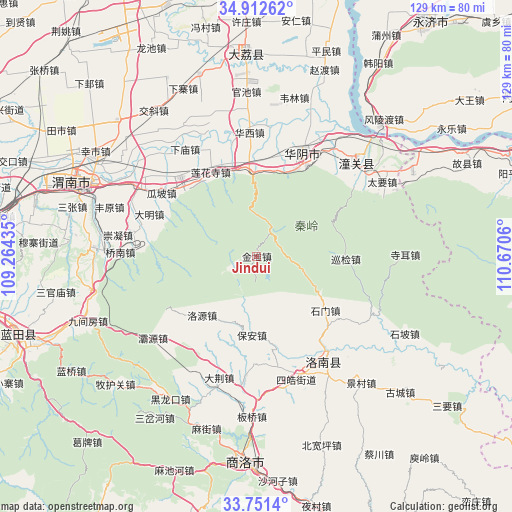
Jindui GPS coordinates[2]
34° 20' 2.472" North, 109° 58' 2.892" East
| Map corner | latitude | longitude |
|---|---|---|
| Upper-left | 34.91262°, | 109.26435° |
| Center: | 34.33402°, | 109.96747° |
| Lower-right: | 33.7514°, | 110.6706° |
| Map W x H: | 129.1×129.1 km | = 80.2×80.2mi |
| max Lat: | 53.31946° ⇑28.3% North |
| Jindui: | 34.33402° |
| min Lat: | ⇓71.7% South 18.22056° |
| min Long | Jindui | max Long |
| 75.07348° | 109.96747° | 134.28917° |
| W 28.6%⇐ | ⇒71.4% E |
Elevation
Elevation of Jindui is 1375 m = 4511 ft, and this is 890.2 m = 2921 ft above average elevation for this country.
| Max E: |
5622 m = 18445 ft | 9.8% |
| Jindui | 1375 m 4511 ft | |
| Avg. | 484.8 m = 1591 ft | |
Min E: |
-3 m = -10 ft | 90.2% |
See also: China elevation on elevation.city.
Geographical zone
Jindui is located in North temperate zone (between Tropic of Cancer and the Arctic Circle). Distance of this Northern Tropic circle is 1211.7 km =752.9 mi to South.| Distance of | km | miles | from Jindui |
|---|---|---|---|
| North Pole | 6189.5 | 3846 | to North |
| Arctic Circle | 3583.6 | 2226.7 | to North |
| Tropic Cancer | 1211.7 | 752.9 | to South |
| Equator | 3817.6 | 2372.1 | to South |


Nearby cities:
15 places around Jindui: (largest is in red/bold)
• Bao’an
19.9 km =12.4 mi,  183°
183°
• Bijia
30 km =18.6 mi,  336°
336°
• Daming
29.1 km =18.1 mi,  291°
291°
• Fushui
23.7 km =14.7 mi,  356°
356°
• Gaotang
30.1 km =18.7 mi, 285°
• Guapo
28.8 km =17.9 mi,  303°
303°
• Huayang
9.4 km =5.8 mi,  14°
14°
• Huayin
27.3 km =17 mi,  19°
19°
• Huazhou
27.9 km =17.3 mi,  316°
316°
• Jinhui
26.8 km =16.7 mi, 293°
• Lianhuasi
24.2 km =15 mi,  331°
331°
• Liuzhi
25 km =15.5 mi, 336°
• Luoyuan
20.3 km =12.6 mi,  222°
222°
• Taoxia
23.3 km =14.5 mi,  2°
2°
• Xinglin
26 km =16.2 mi,  313°
313°
Sources, notices
• [Note1] Compared only with cities in China existing in our database
• [Src1] Map data: © OpenStreetMap contributors (CC-BY-SA)
• [Src2] Other city data from geonames.org with taken over terms of usage.
• [Src3] Geographical zone / Annual Mean Temperature by Robert A. Rohde @ Wikipedia
