Fengkou geodata
Fengkou (Hubei) is a seat of a fourth-order administrative division; located in China in Asia/Shanghai (GMT+8) time zone. With population of 67,139 people, there are 640 cities with bigger population in this country. Compared to other cities in China, 53.1% of cities are located further ↑North; 55.4% of cities are located further →East and 79.3% of cities have higher elevation than Fengkou. Note1


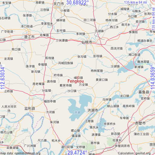
Fengkou GPS coordinates[2]
30° 4' 57.648" North, 113° 20' 0.456" East
| Map corner | latitude | longitude |
|---|---|---|
| Upper-left | 30.68922°, | 112.63034° |
| Center: | 30.08268°, | 113.33346° |
| Lower-right: | 29.4724°, | 114.03659° |
| Map W x H: | 135.3×135.3 km | = 84.1×84.1mi |
| max Lat: | 53.31946° ⇑53.1% North |
| Fengkou: | 30.08268° |
| min Lat: | ⇓46.9% South 18.22056° |
| min Long | Fengkou | max Long |
| 75.07348° | 113.33346° | 134.28917° |
| W 44.6%⇐ | ⇒55.4% E |
Elevation
Elevation of Fengkou is 28 m = 92 ft, and this is 456.8 m = 1499 ft below average elevation for this country.
| Max E: |
5622 m = 18445 ft | 79.3% |
| Avg. | 484.8 m = 1591 ft | |
| Fengkou | 28 m = 92 ft | |
Min E: |
-3 m = -10 ft | 20.7% |
See also: Fengkou elevation on elevation.city.
Geographical zone
Fengkou is located in North temperate zone (between Tropic of Cancer and the Arctic Circle). Distance of this Northern Tropic circle is 739 km =459.2 mi to South.| Distance of | km | miles | from Fengkou |
|---|---|---|---|
| North Pole | 6662.2 | 4139.7 | to North |
| Arctic Circle | 4056.3 | 2520.5 | to North |
| Tropic Cancer | 739 | 459.2 | to South |
| Equator | 3344.9 | 2078.4 | to South |


Nearby cities:
15 places around Fengkou: (largest is in red/bold)
• Caoshi
11.5 km =7.1 mi,  275°
275°
• Chahe
15.8 km =9.8 mi,  126°
126°
• Daijiachang
12.1 km =7.5 mi,  241°
241°
• Fuchang
17.4 km =10.8 mi, 276°
• Gongchang
23.1 km =14.4 mi,  262°
262°
• Guohe
18.6 km =11.6 mi,  347°
347°
• Huangjiakou
20.9 km =13 mi,  94°
94°
• Mianchenghuizu
16.6 km =10.3 mi,  320°
320°
• Qujiawan
18.9 km =11.7 mi,  227°
227°
• Shakou
12 km =7.5 mi,  202°
202°
• Tonghaikou
21.7 km =13.5 mi,  305°
305°
• Wangshi
22.2 km =13.8 mi, 278°
• Wanquan
7.8 km =4.8 mi,  139°
139°
• Yanglinwei
18 km =11.2 mi,  71°
71°
• Zhanggou
18.9 km =11.7 mi,  11°
11°
Sources, notices
• [Note1] Compared only with cities in China existing in our database
• [Src1] Map data: © OpenStreetMap contributors (CC-BY-SA)
• [Src2] Other city data from geonames.org with taken over terms of usage.
• [Src3] Geographical zone / Annual Mean Temperature by Robert A. Rohde @ Wikipedia
