Chahe geodata
Chahe (Hubei) is a seat of a fourth-order administrative division; located in China in Asia/Shanghai (GMT+8) time zone. In our database, there are 1268 cities with bigger population. Compared to other cities in China, 54% of cities are located further ↑North; 54.5% of cities are located further →East and 80.8% of cities have higher elevation than Chahe. Note1


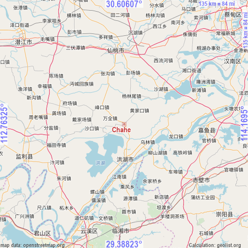
Chahe GPS coordinates[2]
29° 59' 56.472" North, 113° 27' 58.932" East
| Map corner | latitude | longitude |
|---|---|---|
| Upper-left | 30.60607°, | 112.76325° |
| Center: | 29.99902°, | 113.46637° |
| Lower-right: | 29.38823°, | 114.1695° |
| Map W x H: | 135.4×135.4 km | = 84.1×84.1mi |
| max Lat: | 53.31946° ⇑54% North |
| Chahe: | 29.99902° |
| min Lat: | ⇓46% South 18.22056° |
| min Long | Chahe | max Long |
| 75.07348° | 113.46637° | 134.28917° |
| W 45.5%⇐ | ⇒54.5% E |
Elevation
Elevation of Chahe is 25 m = 82 ft, and this is 459.8 m = 1509 ft below average elevation for this country.
| Max E: |
5622 m = 18445 ft | 80.8% |
| Avg. | 484.8 m = 1591 ft | |
| Chahe | 25 m = 82 ft | |
Min E: |
-3 m = -10 ft | 19.2% |
See also: China elevation on elevation.city.
Geographical zone
Chahe is located in North temperate zone (between Tropic of Cancer and the Arctic Circle). Distance of this Northern Tropic circle is 729.7 km =453.4 mi to South.| Distance of | km | miles | from Chahe |
|---|---|---|---|
| North Pole | 6671.5 | 4145.5 | to North |
| Arctic Circle | 4065.6 | 2526.2 | to North |
| Tropic Cancer | 729.7 | 453.4 | to South |
| Equator | 3335.6 | 2072.6 | to South |


Nearby cities:
15 places around Chahe: (largest is in red/bold)
• Caoshi
26.3 km =16.3 mi,  293°
293°
• Chibi
20.3 km =12.6 mi,  131°
131°
• Daijiachang
23.8 km =14.8 mi,  278°
278°
• Fengkou
15.8 km =9.8 mi,  306°
306°
• Huangjiakou
11.2 km =7 mi,  45°
45°
• Liushanhu
23.1 km =14.4 mi, 131°
• Luxi
22.4 km =13.9 mi,  113°
113°
• Qujiawan
27 km =16.8 mi,  262°
262°
• Shahu
27.7 km =17.2 mi, 45°
• Shakou
17.5 km =10.9 mi, 264°
• Wanquan
8.4 km =5.2 mi, 293°
• Wulin
15.7 km =9.8 mi, 127°
• Xindi
20.3 km =12.6 mi,  179°
179°
• Yanglinwei
15.7 km =9.8 mi,  15°
15°
• Zhouhe
26.8 km =16.7 mi,  244°
244°
Sources, notices
• [Note1] Compared only with cities in China existing in our database
• [Src1] Map data: © OpenStreetMap contributors (CC-BY-SA)
• [Src2] Other city data from geonames.org with taken over terms of usage.
• [Src3] Geographical zone / Annual Mean Temperature by Robert A. Rohde @ Wikipedia
