Nanjie geodata
Nanjie (Shanxi) is a seat of a fourth-order administrative division; located in China in Asia/Shanghai (GMT+8) time zone. In our database, there are 1268 cities with bigger population. Compared to other cities in China, 75.8% of cities are located further ↓South; 65.9% of cities are located further →East and 73.7% of cities have lower elevation than Nanjie. Note1


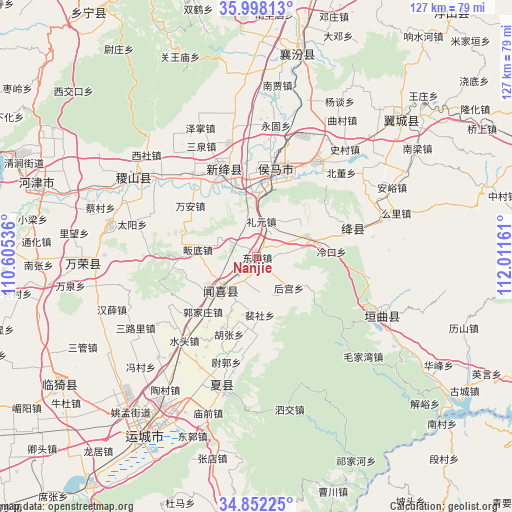
Nanjie GPS coordinates[2]
35° 25' 38.028" North, 111° 18' 30.528" East
| Map corner | latitude | longitude |
|---|---|---|
| Upper-left | 35.99813°, | 110.60536° |
| Center: | 35.42723°, | 111.30848° |
| Lower-right: | 34.85225°, | 112.01161° |
| Map W x H: | 127.4×127.4 km | = 79.2×79.2mi |
| max Lat: | 53.31946° ⇑24.2% North |
| Nanjie: | 35.42723° |
| min Lat: | ⇓75.8% South 18.22056° |
| min Long | Nanjie | max Long |
| 75.07348° | 111.30848° | 134.28917° |
| W 34.1%⇐ | ⇒65.9% E |
Elevation
Elevation of Nanjie is 491 m = 1611 ft, and this is 6.2 m = 20 ft above average elevation for this country.
| Max E: |
5622 m = 18445 ft | 26.3% |
| Nanjie | 491 m 1611 ft | |
| Avg. | 484.8 m = 1591 ft | |
Min E: |
-3 m = -10 ft | 73.7% |
See also: China elevation on elevation.city.
Geographical zone
Nanjie is located in North temperate zone (between Tropic of Cancer and the Arctic Circle). Distance of this Northern Tropic circle is 1333.2 km =828.4 mi to South.| Distance of | km | miles | from Nanjie |
|---|---|---|---|
| North Pole | 6067.9 | 3770.4 | to North |
| Arctic Circle | 3462 | 2151.2 | to North |
| Tropic Cancer | 1333.2 | 828.4 | to South |
| Equator | 3939.1 | 2447.6 | to South |


Nearby cities:
15 places around Nanjie: (largest is in red/bold)
• Donggaocun
19.5 km =12.1 mi,  355°
355°
• Guojiazhuang
19 km =11.8 mi,  224°
224°
• Hedi
11.3 km =7 mi,  157°
157°
• Hengqiao
18.4 km =11.4 mi,  335°
335°
• Houcun
4 km =2.5 mi,  107°
107°
• Hougong
11.2 km =7 mi,  133°
133°
• Liyuan
9 km =5.6 mi,  8°
8°
• Peishe
14.5 km =9 mi,  176°
176°
• Shangma
18.3 km =11.4 mi, 9°
• Shenbai
16 km =9.9 mi,  245°
245°
• Tongcheng
11.6 km =7.2 mi,  226°
226°
• Xuedian
11 km =6.8 mi,  295°
295°
• Yangwang
19.6 km =12.2 mi, 296°
• Yangyu
19.7 km =12.2 mi,  267°
267°
• Zhongwadi
14.3 km =8.9 mi,  277°
277°
Sources, notices
• [Note1] Compared only with cities in China existing in our database
• [Src1] Map data: © OpenStreetMap contributors (CC-BY-SA)
• [Src2] Other city data from geonames.org with taken over terms of usage.
• [Src3] Geographical zone / Annual Mean Temperature by Robert A. Rohde @ Wikipedia
