Dongshi geodata
Dongshi (Hunan) is a seat of a fourth-order administrative division; located in China in Asia/Shanghai (GMT+8) time zone. In our database, there are 1268 cities with bigger population. Compared to other cities in China, 56.2% of cities are located further ↑North; 65.6% of cities are located further →East and 51.1% of cities have lower elevation than Dongshi. Note1


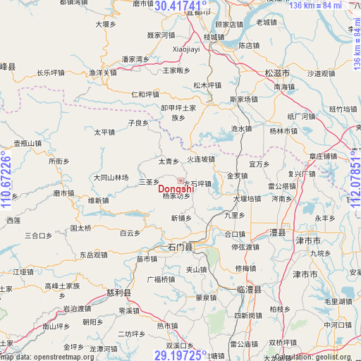
Dongshi GPS coordinates[2]
29° 48' 33.084" North, 111° 22' 31.368" East
| Map corner | latitude | longitude |
|---|---|---|
| Upper-left | 30.41741°, | 110.67226° |
| Center: | 29.80919°, | 111.37538° |
| Lower-right: | 29.19725°, | 112.07851° |
| Map W x H: | 135.7×135.7 km | = 84.3×84.3mi |
| max Lat: | 53.31946° ⇑56.2% North |
| Dongshi: | 29.80919° |
| min Lat: | ⇓43.8% South 18.22056° |
| min Long | Dongshi | max Long |
| 75.07348° | 111.37538° | 134.28917° |
| W 34.4%⇐ | ⇒65.6% E |
Elevation
Elevation of Dongshi is 174 m = 571 ft, and this is 310.8 m = 1020 ft below average elevation for this country.
| Max E: |
5622 m = 18445 ft | 48.9% |
| Avg. | 484.8 m = 1591 ft | |
| Dongshi | 174 m = 571 ft | |
Min E: |
-3 m = -10 ft | 51.1% |
See also: China elevation on elevation.city.
Geographical zone
Dongshi is located in North temperate zone (between Tropic of Cancer and the Arctic Circle). Distance of this Northern Tropic circle is 708.6 km =440.3 mi to South.| Distance of | km | miles | from Dongshi |
|---|---|---|---|
| North Pole | 6692.6 | 4158.6 | to North |
| Arctic Circle | 4086.7 | 2539.4 | to North |
| Tropic Cancer | 708.6 | 440.3 | to South |
| Equator | 3314.5 | 2059.5 | to South |


Nearby cities:
15 places around Dongshi: (largest is in red/bold)
• Fangshiping
6.1 km =3.8 mi,  98°
98°
• Ganxitan
6.5 km =4 mi,  0°
0°
• Guanting
19.7 km =12.2 mi,  123°
123°
• Huolianpo
11.2 km =7 mi,  42°
42°
• Jinluo
21.5 km =13.4 mi,  89°
89°
• Matoupu
5.5 km =3.4 mi,  140°
140°
• Sansheng
12.3 km =7.6 mi,  268°
268°
• Taiqing
9.5 km =5.9 mi,  320°
320°
• Wangjiachang
16.2 km =10.1 mi,  109°
109°
• Xinguan
22.1 km =13.7 mi,  197°
197°
• Xinpu
14.2 km =8.8 mi,  178°
178°
• Xin’an
21.4 km =13.3 mi,  145°
145°
• Yangjiafang
6.2 km =3.9 mi, 196°
• Zaoshi
21.9 km =13.6 mi,  218°
218°
• Zhakou
13 km =8.1 mi,  68°
68°
Sources, notices
• [Note1] Compared only with cities in China existing in our database
• [Src1] Map data: © OpenStreetMap contributors (CC-BY-SA)
• [Src2] Other city data from geonames.org with taken over terms of usage.
• [Src3] Geographical zone / Annual Mean Temperature by Robert A. Rohde @ Wikipedia
