Yatou geodata
Yatou (Shandong) is a seat of a third-order administrative division; located in China in Asia/Shanghai (GMT+8) time zone. With population of 91,517 people, there are 462 cities with bigger population in this country. Compared to other cities in China, 79.5% of cities are located further ↓South; 92% of cities are located further ←West and 87.7% of cities have higher elevation than Yatou. Note1


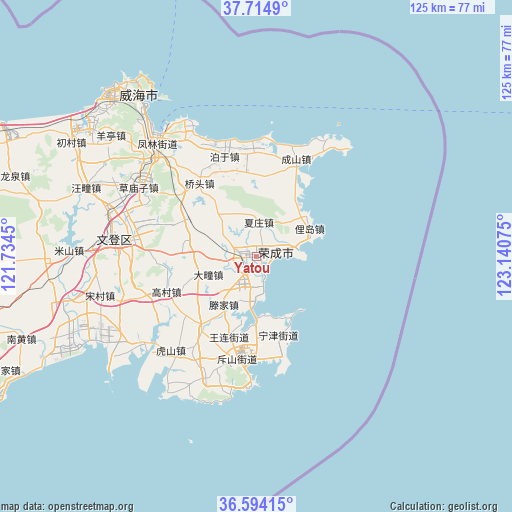
Yatou GPS coordinates[2]
37° 9' 23.76" North, 122° 26' 15.432" East
| Map corner | latitude | longitude |
|---|---|---|
| Upper-left | 37.7149°, | 121.7345° |
| Center: | 37.1566°, | 122.43762° |
| Lower-right: | 36.59415°, | 123.14075° |
| Map W x H: | 124.6×124.6 km | = 77.4×77.4mi |
| max Lat: | 53.31946° ⇑20.5% North |
| Yatou: | 37.1566° |
| min Lat: | ⇓79.5% South 18.22056° |
| min Long | Yatou | max Long |
| 75.07348° | 122.43762° | 134.28917° |
| W 92%⇐ | ⇒8% E |
Elevation
Elevation of Yatou is 12 m = 39 ft, and this is 472.8 m = 1551 ft below average elevation for this country.
| Max E: |
5622 m = 18445 ft | 87.7% |
| Avg. | 484.8 m = 1591 ft | |
| Yatou | 12 m = 39 ft | |
Min E: |
-3 m = -10 ft | 12.3% |
See also: Yatou elevation on elevation.city.
Geographical zone
Yatou is located in North temperate zone (between Tropic of Cancer and the Arctic Circle). Distance of this Northern Tropic circle is 1525.5 km =947.9 mi to South.| Distance of | km | miles | from Yatou |
|---|---|---|---|
| North Pole | 5875.6 | 3650.9 | to North |
| Arctic Circle | 3269.7 | 2031.7 | to North |
| Tropic Cancer | 1525.5 | 947.9 | to South |
| Equator | 4131.4 | 2567.1 | to South |


Nearby cities:
15 places around Yatou: (largest is in red/bold)
• Buliu
20.1 km =12.5 mi,  358°
358°
• Dashuipo
17.2 km =10.7 mi,  280°
280°
• Datuan
12.3 km =7.6 mi,  249°
249°
• Dongshan
21.5 km =13.4 mi,  179°
179°
• Gaocun
23.1 km =14.4 mi, 249°
• Lidao
15.2 km =9.4 mi,  58°
58°
• Ningjin
19.8 km =12.3 mi,  163°
163°
• Qiaotou
22.7 km =14.1 mi,  322°
322°
• Shangzhuang
22 km =13.7 mi,  217°
217°
• Taoyuan
24.9 km =15.5 mi, 178°
• Tengjia
13.3 km =8.3 mi, 216°
• Wanglian
20.1 km =12.5 mi,  198°
198°
• Xiazhuang
8.5 km =5.3 mi,  8°
8°
• Yaxi
12.4 km =7.7 mi,  329°
329°
• Yinzi
12.8 km =8 mi,  300°
300°
Sources, notices
• [Note1] Compared only with cities in China existing in our database
• [Src1] Map data: © OpenStreetMap contributors (CC-BY-SA)
• [Src2] Other city data from geonames.org with taken over terms of usage.
• [Src3] Geographical zone / Annual Mean Temperature by Robert A. Rohde @ Wikipedia
