Chunwan geodata
Chunwan (Guangdong) is a seat of a fourth-order administrative division; located in China in Asia/Shanghai (GMT+8) time zone. In our database, there are 1268 cities with bigger population. Compared to other cities in China, 96.5% of cities are located further ↑North; 63% of cities are located further →East and 74.1% of cities have higher elevation than Chunwan. Note1


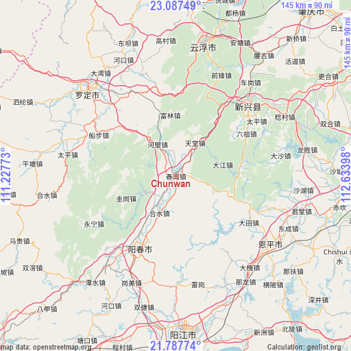
Chunwan GPS coordinates[2]
22° 26' 20.904" North, 111° 55' 51.06" East
| Map corner | latitude | longitude |
|---|---|---|
| Upper-left | 23.08749°, | 111.22773° |
| Center: | 22.43914°, | 111.93085° |
| Lower-right: | 21.78774°, | 112.63398° |
| Map W x H: | 144.5×144.5 km | = 89.8×89.8mi |
| max Lat: | 53.31946° ⇑96.5% North |
| Chunwan: | 22.43914° |
| min Lat: | ⇓3.5% South 18.22056° |
| min Long | Chunwan | max Long |
| 75.07348° | 111.93085° | 134.28917° |
| W 37%⇐ | ⇒63% E |
Elevation
Elevation of Chunwan is 39 m = 128 ft, and this is 445.8 m = 1463 ft below average elevation for this country.
| Max E: |
5622 m = 18445 ft | 74.1% |
| Avg. | 484.8 m = 1591 ft | |
| Chunwan | 39 m = 128 ft | |
Min E: |
-3 m = -10 ft | 25.9% |
See also: China elevation on elevation.city.
Geographical zone
Chunwan is located in North Torrid zone (between Equator and Tropic of Cancer). Distance of this Northern Tropic circle is 110.9 km =68.9 mi to North.| Distance of | km | miles | from Chunwan |
|---|---|---|---|
| North Pole | 7512.1 | 4667.8 | to North |
| Arctic Circle | 4906.2 | 3048.6 | to North |
| Tropic Cancer | 110.9 | 68.9 | to North |
| Equator | 2495 | 1550.3 | to South |


Nearby cities:
15 places around Chunwan: (largest is in red/bold)
• Bingtang
30.9 km =19.2 mi,  311°
311°
• Chuncheng
33.1 km =20.6 mi,  206°
206°
• Dajiang
19.8 km =12.3 mi,  76°
76°
• Fulin
25.1 km =15.6 mi,  351°
351°
• Guigang
22.4 km =13.9 mi,  246°
246°
• Helang
15.1 km =9.4 mi,  330°
330°
• Heshui
16.6 km =10.3 mi,  203°
203°
• Hetou
19.9 km =12.4 mi,  35°
35°
• Jinji
32.5 km =20.2 mi,  339°
339°
• Lidong
26 km =16.2 mi, 83°
• Pimian
13.6 km =8.5 mi,  219°
219°
• Shiwang
9.8 km =6.1 mi,  358°
358°
• Songbai
6.9 km =4.3 mi, 312°
• Tiantang
15.3 km =9.5 mi,  27°
27°
• Yangchun
33.9 km =21.1 mi, 206°
Sources, notices
• [Note1] Compared only with cities in China existing in our database
• [Src1] Map data: © OpenStreetMap contributors (CC-BY-SA)
• [Src2] Other city data from geonames.org with taken over terms of usage.
• [Src3] Geographical zone / Annual Mean Temperature by Robert A. Rohde @ Wikipedia
