Chongru geodata
Chongru (Fujian) is a populated place; located in China in Asia/Shanghai (GMT+8) time zone. With population of 2,800 people, there are 962 cities with bigger population in this country. Compared to other cities in China, 78.8% of cities are located further ↑North; 81.4% of cities are located further ←West and 59% of cities have lower elevation than Chongru. Note1


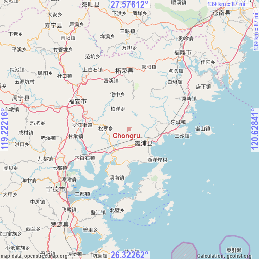
Chongru GPS coordinates[2]
26° 57' 3.996" North, 119° 55' 31.008" East
| Map corner | latitude | longitude |
|---|---|---|
| Upper-left | 27.57612°, | 119.22216° |
| Center: | 26.95111°, | 119.92528° |
| Lower-right: | 26.32262°, | 120.62841° |
| Map W x H: | 139.4×139.4 km | = 86.6×86.6mi |
| max Lat: | 53.31946° ⇑78.8% North |
| Chongru: | 26.95111° |
| min Lat: | ⇓21.2% South 18.22056° |
| min Long | Chongru | max Long |
| 75.07348° | 119.92528° | 134.28917° |
| W 81.4%⇐ | ⇒18.6% E |
Elevation
Elevation of Chongru is 247 m = 810 ft, and this is 237.8 m = 780 ft below average elevation for this country.
| Max E: |
5622 m = 18445 ft | 41% |
| Avg. | 484.8 m = 1591 ft | |
| Chongru | 247 m = 810 ft | |
Min E: |
-3 m = -10 ft | 59% |
See also: China elevation on elevation.city.
Geographical zone
Chongru is located in North temperate zone (between Tropic of Cancer and the Arctic Circle). Distance of this Northern Tropic circle is 390.8 km =242.8 mi to South.| Distance of | km | miles | from Chongru |
|---|---|---|---|
| North Pole | 7010.4 | 4356.1 | to North |
| Arctic Circle | 4404.5 | 2736.8 | to North |
| Tropic Cancer | 390.8 | 242.8 | to South |
| Equator | 2996.7 | 1862.1 | to South |


Nearby cities:
15 places around Chongru: (largest is in red/bold)
• Baiyang
13 km =8.1 mi,  331°
331°
• Changchun
27.2 km =16.9 mi,  155°
155°
• Dingtoucun
29 km =18 mi,  244°
244°
• Fuxi
28.3 km =17.6 mi,  339°
339°
• Gantang
29.1 km =18.1 mi,  263°
263°
• Sansha
28.3 km =17.6 mi,  96°
96°
• Shajiang
19.2 km =11.9 mi,  167°
167°
• Shuimen
14.4 km =8.9 mi,  80°
80°
• Songcheng
10.8 km =6.7 mi,  135°
135°
• Xiabaishi
28.7 km =17.8 mi, 238°
• Xibing
20.2 km =12.6 mi,  279°
279°
• Xinan
26.6 km =16.5 mi,  195°
195°
• Yacheng
26.4 km =16.4 mi, 80°
• Yantian
12.8 km =8 mi,  211°
211°
• Zhaizhong
20.3 km =12.6 mi, 341°
Sources, notices
• [Note1] Compared only with cities in China existing in our database
• [Src1] Map data: © OpenStreetMap contributors (CC-BY-SA)
• [Src2] Other city data from geonames.org with taken over terms of usage.
• [Src3] Geographical zone / Annual Mean Temperature by Robert A. Rohde @ Wikipedia
