Shajiang geodata
Shajiang (Fujian) is a populated place; located in China in Asia/Shanghai (GMT+8) time zone. With population of 6,310 people, there are 846 cities with bigger population in this country. Compared to other cities in China, 79.5% of cities are located further ↑North; 81.7% of cities are located further ←West and 86.9% of cities have higher elevation than Shajiang. Note1


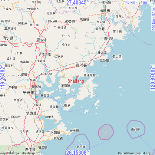
Shajiang GPS coordinates[2]
26° 46' 57" North, 119° 58' 0.984" East
| Map corner | latitude | longitude |
|---|---|---|
| Upper-left | 27.40845°, | 119.26382° |
| Center: | 26.7825°, | 119.96694° |
| Lower-right: | 26.15308°, | 120.67007° |
| Map W x H: | 139.6×139.6 km | = 86.7×86.7mi |
| max Lat: | 53.31946° ⇑79.5% North |
| Shajiang: | 26.7825° |
| min Lat: | ⇓20.5% South 18.22056° |
| min Long | Shajiang | max Long |
| 75.07348° | 119.96694° | 134.28917° |
| W 81.7%⇐ | ⇒18.3% E |
Elevation
Elevation of Shajiang is 13 m = 43 ft, and this is 471.8 m = 1548 ft below average elevation for this country.
| Max E: |
5622 m = 18445 ft | 86.9% |
| Avg. | 484.8 m = 1591 ft | |
| Shajiang | 13 m = 43 ft | |
Min E: |
-3 m = -10 ft | 13.1% |
See also: China elevation on elevation.city.
Geographical zone
Shajiang is located in North temperate zone (between Tropic of Cancer and the Arctic Circle). Distance of this Northern Tropic circle is 372 km =231.2 mi to South.| Distance of | km | miles | from Shajiang |
|---|---|---|---|
| North Pole | 7029.1 | 4367.7 | to North |
| Arctic Circle | 4423.2 | 2748.4 | to North |
| Tropic Cancer | 372 | 231.2 | to South |
| Equator | 2977.9 | 1850.4 | to South |


Nearby cities:
15 places around Shajiang: (largest is in red/bold)
• Baiyang
31.9 km =19.8 mi,  340°
340°
• Changchun
9.4 km =5.8 mi,  129°
129°
• Chongru
19.2 km =11.9 mi,  347°
347°
• Dingtoucun
31 km =19.3 mi,  281°
281°
• Dongchongcun
30.1 km =18.7 mi,  206°
206°
• Haidao
32 km =19.9 mi,  165°
165°
• Sansha
28.7 km =17.8 mi,  56°
56°
• Shuimen
23.3 km =14.5 mi,  25°
25°
• Songcheng
11.6 km =7.2 mi,  17°
17°
• Xiabaishi
28.8 km =17.9 mi, 277°
• Xiahu
19.2 km =11.9 mi,  185°
185°
• Xibing
32.7 km =20.3 mi,  312°
312°
• Xinan
13.1 km =8.1 mi,  237°
237°
• Yacheng
31.7 km =19.7 mi,  43°
43°
• Yantian
13.4 km =8.3 mi, 305°
Sources, notices
• [Note1] Compared only with cities in China existing in our database
• [Src1] Map data: © OpenStreetMap contributors (CC-BY-SA)
• [Src2] Other city data from geonames.org with taken over terms of usage.
• [Src3] Geographical zone / Annual Mean Temperature by Robert A. Rohde @ Wikipedia
