Chetou geodata
Chetou (Jiangxi) is a seat of a fourth-order administrative division; located in China in Asia/Shanghai (GMT+8) time zone. In our database, there are 1268 cities with bigger population. Compared to other cities in China, 85.6% of cities are located further ↑North; 56% of cities are located further ←West and 59.8% of cities have lower elevation than Chetou. Note1


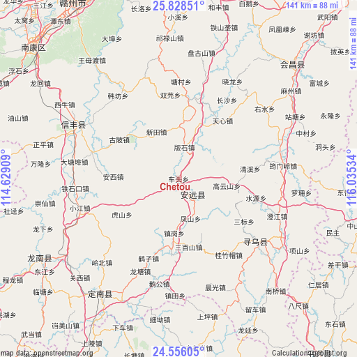
Chetou GPS coordinates[2]
25° 11' 38.184" North, 115° 19' 55.956" East
| Map corner | latitude | longitude |
|---|---|---|
| Upper-left | 25.82851°, | 114.62909° |
| Center: | 25.19394°, | 115.33221° |
| Lower-right: | 24.55605°, | 116.03534° |
| Map W x H: | 141.5×141.5 km | = 87.9×87.9mi |
| max Lat: | 53.31946° ⇑85.6% North |
| Chetou: | 25.19394° |
| min Lat: | ⇓14.4% South 18.22056° |
| min Long | Chetou | max Long |
| 75.07348° | 115.33221° | 134.28917° |
| W 56%⇐ | ⇒44% E |
Elevation
Elevation of Chetou is 257 m = 843 ft, and this is 227.8 m = 747 ft below average elevation for this country.
| Max E: |
5622 m = 18445 ft | 40.2% |
| Avg. | 484.8 m = 1591 ft | |
| Chetou | 257 m = 843 ft | |
Min E: |
-3 m = -10 ft | 59.8% |
See also: China elevation on elevation.city.
Geographical zone
Chetou is located in North temperate zone (between Tropic of Cancer and the Arctic Circle). Distance of this Northern Tropic circle is 195.4 km =121.4 mi to South.| Distance of | km | miles | from Chetou |
|---|---|---|---|
| North Pole | 7205.8 | 4477.5 | to North |
| Arctic Circle | 4599.9 | 2858.2 | to North |
| Tropic Cancer | 195.4 | 121.4 | to South |
| Equator | 2801.3 | 1740.6 | to South |


Nearby cities:
15 places around Chetou: (largest is in red/bold)
• Anxi
25.9 km =16.1 mi,  272°
272°
• Banshi
12.7 km =7.9 mi,  10°
10°
• Caifang
16.4 km =10.2 mi,  43°
43°
• Daqiao
25.5 km =15.8 mi,  313°
313°
• Fengshan
16.4 km =10.2 mi,  162°
162°
• Gaoyunshan
19.3 km =12 mi,  98°
98°
• Gubei
28.2 km =17.5 mi,  303°
303°
• Hushan
26.5 km =16.5 mi,  237°
237°
• Lianjiang
9.3 km =5.8 mi,  138°
138°
• Sanbaishan
27.3 km =17 mi,  171°
171°
• Xinlong
5.5 km =3.4 mi,  185°
185°
• Xinshan
8.4 km =5.2 mi, 138°
• Xintian
20.6 km =12.8 mi,  334°
334°
• Zhengang
21.6 km =13.4 mi,  184°
184°
• Zhongshi
23.1 km =14.4 mi,  21°
21°
Sources, notices
• [Note1] Compared only with cities in China existing in our database
• [Src1] Map data: © OpenStreetMap contributors (CC-BY-SA)
• [Src2] Other city data from geonames.org with taken over terms of usage.
• [Src3] Geographical zone / Annual Mean Temperature by Robert A. Rohde @ Wikipedia
