Caifang geodata
Caifang (Jiangxi) is a seat of a fourth-order administrative division; located in China in Asia/Shanghai (GMT+8) time zone. In our database, there are 1268 cities with bigger population. Compared to other cities in China, 85.1% of cities are located further ↑North; 56.7% of cities are located further ←West and 58.7% of cities have lower elevation than Caifang. Note1


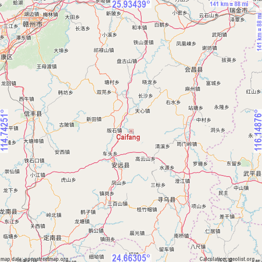
Caifang GPS coordinates[2]
25° 18' 1.404" North, 115° 26' 44.268" East
| Map corner | latitude | longitude |
|---|---|---|
| Upper-left | 25.93439°, | 114.74251° |
| Center: | 25.30039°, | 115.44563° |
| Lower-right: | 24.66305°, | 116.14876° |
| Map W x H: | 141.4×141.4 km | = 87.9×87.9mi |
| max Lat: | 53.31946° ⇑85.1% North |
| Caifang: | 25.30039° |
| min Lat: | ⇓14.9% South 18.22056° |
| min Long | Caifang | max Long |
| 75.07348° | 115.44563° | 134.28917° |
| W 56.7%⇐ | ⇒43.3% E |
Elevation
Elevation of Caifang is 244 m = 801 ft, and this is 240.8 m = 790 ft below average elevation for this country.
| Max E: |
5622 m = 18445 ft | 41.3% |
| Avg. | 484.8 m = 1591 ft | |
| Caifang | 244 m = 801 ft | |
Min E: |
-3 m = -10 ft | 58.7% |
See also: China elevation on elevation.city.
Geographical zone
Caifang is located in North temperate zone (between Tropic of Cancer and the Arctic Circle). Distance of this Northern Tropic circle is 207.2 km =128.7 mi to South.| Distance of | km | miles | from Caifang |
|---|---|---|---|
| North Pole | 7193.9 | 4470.1 | to North |
| Arctic Circle | 4588 | 2850.9 | to North |
| Tropic Cancer | 207.2 | 128.7 | to South |
| Equator | 2813.1 | 1748 | to South |


Nearby cities:
15 places around Caifang: (largest is in red/bold)
• Banshi
9.1 km =5.7 mi,  274°
274°
• Changsha
20.9 km =13 mi,  21°
21°
• Chetou
16.4 km =10.2 mi,  223°
223°
• Fucha
26.8 km =16.7 mi,  357°
357°
• Gaopai
26.6 km =16.5 mi,  37°
37°
• Gaoyunshan
16.5 km =10.3 mi,  152°
152°
• Lianjiang
19.5 km =12.1 mi,  195°
195°
• Longbu
20.5 km =12.7 mi,  340°
340°
• Qingxi
18.7 km =11.6 mi,  114°
114°
• Shuangyuan
25.9 km =16.1 mi,  325°
325°
• Tianxin
12.4 km =7.7 mi,  28°
28°
• Xinlong
21 km =13 mi,  214°
214°
• Xinshan
19.1 km =11.9 mi, 197°
• Xintian
21.2 km =13.2 mi,  288°
288°
• Zhongshi
10.1 km =6.3 mi, 343°
Sources, notices
• [Note1] Compared only with cities in China existing in our database
• [Src1] Map data: © OpenStreetMap contributors (CC-BY-SA)
• [Src2] Other city data from geonames.org with taken over terms of usage.
• [Src3] Geographical zone / Annual Mean Temperature by Robert A. Rohde @ Wikipedia
