Gaoyunshan geodata
Gaoyunshan (Jiangxi) is a seat of a fourth-order administrative division; located in China in Asia/Shanghai (GMT+8) time zone. In our database, there are 1268 cities with bigger population. Compared to other cities in China, 85.7% of cities are located further ↑North; 57.1% of cities are located further ←West and 78.2% of cities have lower elevation than Gaoyunshan. Note1


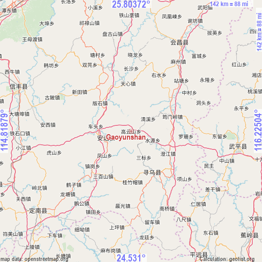
Gaoyunshan GPS coordinates[2]
25° 10' 8.472" North, 115° 31' 18.876" East
| Map corner | latitude | longitude |
|---|---|---|
| Upper-left | 25.80372°, | 114.81879° |
| Center: | 25.16902°, | 115.52191° |
| Lower-right: | 24.531°, | 116.22504° |
| Map W x H: | 141.5×141.5 km | = 87.9×87.9mi |
| max Lat: | 53.31946° ⇑85.7% North |
| Gaoyunshan: | 25.16902° |
| min Lat: | ⇓14.3% South 18.22056° |
| min Long | Gaoyunshan | max Long |
| 75.07348° | 115.52191° | 134.28917° |
| W 57.1%⇐ | ⇒42.9% E |
Elevation
Elevation of Gaoyunshan is 623 m = 2044 ft, and this is 138.2 m = 453 ft above average elevation for this country.
| Max E: |
5622 m = 18445 ft | 21.8% |
| Gaoyunshan | 623 m 2044 ft | |
| Avg. | 484.8 m = 1591 ft | |
Min E: |
-3 m = -10 ft | 78.2% |
See also: China elevation on elevation.city.
Geographical zone
Gaoyunshan is located in North temperate zone (between Tropic of Cancer and the Arctic Circle). Distance of this Northern Tropic circle is 192.6 km =119.7 mi to South.| Distance of | km | miles | from Gaoyunshan |
|---|---|---|---|
| North Pole | 7208.5 | 4479.2 | to North |
| Arctic Circle | 4602.6 | 2859.9 | to North |
| Tropic Cancer | 192.6 | 119.7 | to South |
| Equator | 2798.5 | 1738.9 | to South |


Nearby cities:
15 places around Gaoyunshan: (largest is in red/bold)
• Banshi
22.7 km =14.1 mi,  312°
312°
• Caifang
16.5 km =10.3 mi,  332°
332°
• Chengjiang
23.3 km =14.5 mi,  120°
120°
• Chetou
19.3 km =12 mi,  278°
278°
• Fengshan
19.3 km =12 mi,  227°
227°
• Lianjiang
13.6 km =8.5 mi,  252°
252°
• Qingxi
11.4 km =7.1 mi,  54°
54°
• Sanbiao
15.7 km =9.8 mi,  154°
154°
• Shuiyuan
12.6 km =7.8 mi,  112°
112°
• Tianxin
25.5 km =15.8 mi,  356°
356°
• Wenfeng
25.3 km =15.7 mi, 153°
• Xinlong
19.8 km =12.3 mi,  262°
262°
• Xinshan
14 km =8.7 mi, 255°
• Yunmenling
23.8 km =14.8 mi,  70°
70°
• Zhongshi
26.5 km =16.5 mi,  336°
336°
Sources, notices
• [Note1] Compared only with cities in China existing in our database
• [Src1] Map data: © OpenStreetMap contributors (CC-BY-SA)
• [Src2] Other city data from geonames.org with taken over terms of usage.
• [Src3] Geographical zone / Annual Mean Temperature by Robert A. Rohde @ Wikipedia
