Chenglong geodata
Chenglong (Jiangxi) is a seat of a fourth-order administrative division; located in China in Asia/Shanghai (GMT+8) time zone. In our database, there are 1268 cities with bigger population. Compared to other cities in China, 87.1% of cities are located further ↑North; 52.5% of cities are located further ←West and 57.7% of cities have lower elevation than Chenglong. Note1


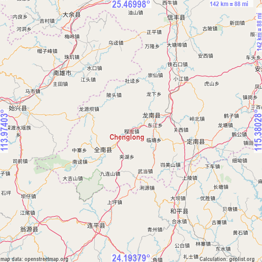
Chenglong GPS coordinates[2]
24° 50' 0.708" North, 114° 40' 37.74" East
| Map corner | latitude | longitude |
|---|---|---|
| Upper-left | 25.46998°, | 113.97403° |
| Center: | 24.83353°, | 114.67715° |
| Lower-right: | 24.19379°, | 115.38028° |
| Map W x H: | 141.9×141.9 km | = 88.2×88.2mi |
| max Lat: | 53.31946° ⇑87.1% North |
| Chenglong: | 24.83353° |
| min Lat: | ⇓12.9% South 18.22056° |
| min Long | Chenglong | max Long |
| 75.07348° | 114.67715° | 134.28917° |
| W 52.5%⇐ | ⇒47.5% E |
Elevation
Elevation of Chenglong is 233 m = 764 ft, and this is 251.8 m = 826 ft below average elevation for this country.
| Max E: |
5622 m = 18445 ft | 42.3% |
| Avg. | 484.8 m = 1591 ft | |
| Chenglong | 233 m = 764 ft | |
Min E: |
-3 m = -10 ft | 57.7% |
See also: China elevation on elevation.city.
Geographical zone
Chenglong is located in North temperate zone (between Tropic of Cancer and the Arctic Circle). Distance of this Northern Tropic circle is 155.3 km =96.5 mi to South.| Distance of | km | miles | from Chenglong |
|---|---|---|---|
| North Pole | 7245.8 | 4502.3 | to North |
| Arctic Circle | 4639.9 | 2883.1 | to North |
| Tropic Cancer | 155.3 | 96.5 | to South |
| Equator | 2761.2 | 1715.7 | to South |


Nearby cities:
15 places around Chenglong: (largest is in red/bold)
• Beitou
20.8 km =12.9 mi,  332°
332°
• Dujiang
4.3 km =2.7 mi,  32°
32°
• Guanxi
26.8 km =16.7 mi,  88°
88°
• Jiahu
13.9 km =8.6 mi,  190°
190°
• Jinlong
17.2 km =10.7 mi,  237°
237°
• Kuimeishan
28.1 km =17.5 mi,  130°
130°
• Lintang
13 km =8.1 mi,  111°
111°
• Liren
21.5 km =13.4 mi,  70°
70°
• Longnan
13 km =8.1 mi,  55°
55°
• Longyuanba
25.9 km =16.1 mi,  298°
298°
• Nanheng
19 km =11.8 mi,  140°
140°
• Taojiang
13.9 km =8.6 mi,  48°
48°
• Wenlong
23.6 km =14.7 mi, 108°
• Wudang
22.8 km =14.2 mi,  160°
160°
• Yangcun
22.4 km =13.9 mi, 192°
Sources, notices
• [Note1] Compared only with cities in China existing in our database
• [Src1] Map data: © OpenStreetMap contributors (CC-BY-SA)
• [Src2] Other city data from geonames.org with taken over terms of usage.
• [Src3] Geographical zone / Annual Mean Temperature by Robert A. Rohde @ Wikipedia
