Chaoshui geodata
Chaoshui (Shandong) is a seat of a fourth-order administrative division; located in China in Asia/Shanghai (GMT+8) time zone. In our database, there are 1268 cities with bigger population. Compared to other cities in China, 80.6% of cities are located further ↓South; 87.7% of cities are located further ←West and 84.3% of cities have higher elevation than Chaoshui. Note1


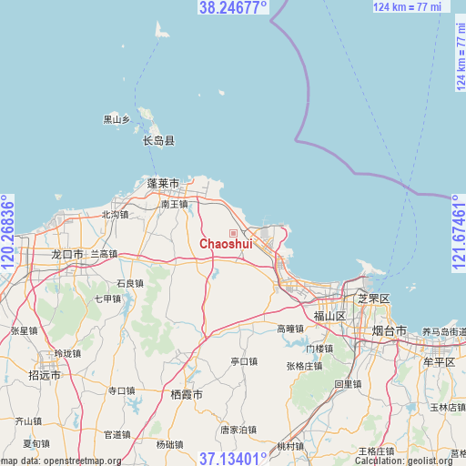
Chaoshui GPS coordinates[2]
37° 41' 32.928" North, 120° 58' 17.328" East
| Map corner | latitude | longitude |
|---|---|---|
| Upper-left | 38.24677°, | 120.26836° |
| Center: | 37.69248°, | 120.97148° |
| Lower-right: | 37.13401°, | 121.67461° |
| Map W x H: | 123.7×123.7 km | = 76.9×76.9mi |
| max Lat: | 53.31946° ⇑19.4% North |
| Chaoshui: | 37.69248° |
| min Lat: | ⇓80.6% South 18.22056° |
| min Long | Chaoshui | max Long |
| 75.07348° | 120.97148° | 134.28917° |
| W 87.7%⇐ | ⇒12.3% E |
Elevation
Elevation of Chaoshui is 17 m = 56 ft, and this is 467.8 m = 1535 ft below average elevation for this country.
| Max E: |
5622 m = 18445 ft | 84.3% |
| Avg. | 484.8 m = 1591 ft | |
| Chaoshui | 17 m = 56 ft | |
Min E: |
-3 m = -10 ft | 15.7% |
See also: China elevation on elevation.city.
Geographical zone
Chaoshui is located in North temperate zone (between Tropic of Cancer and the Arctic Circle). Distance of this Northern Tropic circle is 1585.1 km =984.9 mi to South.| Distance of | km | miles | from Chaoshui |
|---|---|---|---|
| North Pole | 5816.1 | 3614 | to North |
| Arctic Circle | 3210.2 | 1994.7 | to North |
| Tropic Cancer | 1585.1 | 984.9 | to South |
| Equator | 4191 | 2604.2 | to South |


Nearby cities:
15 places around Chaoshui: (largest is in red/bold)
• Beigou
31.8 km =19.8 mi,  279°
279°
• Cunliji
24.2 km =15 mi,  224°
224°
• Dajijia
7.7 km =4.8 mi,  112°
112°
• Daliuhang
11.5 km =7.1 mi,  144°
144°
• Daxindian
13.1 km =8.1 mi,  232°
232°
• Dengzhou
22.7 km =14.1 mi,  304°
304°
• Fuxin
27 km =16.8 mi,  132°
132°
• Gaotuan
29.4 km =18.3 mi,  149°
149°
• Guxian
18.9 km =11.7 mi, 135°
• Liujiagou
11.2 km =7 mi,  317°
317°
• Nanwang
17.6 km =10.9 mi, 296°
• Shiliang
30.2 km =18.8 mi,  244°
244°
• Xiaomenjia
17 km =10.6 mi, 244°
• Xingang
14.3 km =8.9 mi, 322°
• Zangjiazhuang
25.2 km =15.7 mi,  177°
177°
Sources, notices
• [Note1] Compared only with cities in China existing in our database
• [Src1] Map data: © OpenStreetMap contributors (CC-BY-SA)
• [Src2] Other city data from geonames.org with taken over terms of usage.
• [Src3] Geographical zone / Annual Mean Temperature by Robert A. Rohde @ Wikipedia
