Chaling Chengguanzhen geodata
Chaling Chengguanzhen (Hunan) is a seat of a third-order administrative division; located in China in Asia/Shanghai (GMT+8) time zone. In our database, there are 1268 cities with bigger population. Compared to other cities in China, 79.4% of cities are located further ↑North; 54.1% of cities are located further →East and 54.8% of cities have higher elevation than Chaling Chengguanzhen. Note1


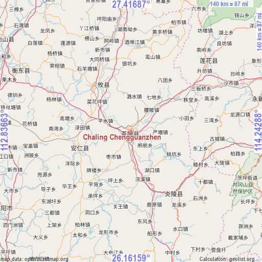
Chaling Chengguanzhen GPS coordinates[2]
26° 47' 27.492" North, 113° 32' 23.1" East
| Map corner | latitude | longitude |
|---|---|---|
| Upper-left | 27.41687°, | 112.83663° |
| Center: | 26.79097°, | 113.53975° |
| Lower-right: | 26.16159°, | 114.24288° |
| Map W x H: | 139.6×139.6 km | = 86.7×86.7mi |
| max Lat: | 53.31946° ⇑79.4% North |
| Chaling Chengguanzhen: | 26.79097° |
| min Lat: | ⇓20.6% South 18.22056° |
| min Long | Chaling Chenggu | max Long |
| 75.07348° | 113.53975° | 134.28917° |
| W 45.9%⇐ | ⇒54.1% E |
Elevation
Elevation of Chaling Chengguanzhen is 133 m = 436 ft, and this is 351.8 m = 1154 ft below average elevation for this country.
| Max E: |
5622 m = 18445 ft | 54.8% |
| Avg. | 484.8 m = 1591 ft | |
| Chaling Chengguanzhen | 133 m = 436 ft | |
Min E: |
-3 m = -10 ft | 45.2% |
See also: China elevation on elevation.city.
Geographical zone
Chaling Chengguanzhen is located in North temperate zone (between Tropic of Cancer and the Arctic Circle). Distance of this Northern Tropic circle is 373 km =231.8 mi to South.| Distance of | km | miles | from Chaling Chengguanzhen |
|---|---|---|---|
| North Pole | 7028.2 | 4367.1 | to North |
| Arctic Circle | 4422.3 | 2747.9 | to North |
| Tropic Cancer | 373 | 231.8 | to South |
| Equator | 2978.9 | 1851 | to South |


Nearby cities:
15 places around Chaling Chengguanzhen: (largest is in red/bold)
• Huju
20.4 km =12.7 mi,  313°
313°
• Hukou
23.3 km =14.5 mi,  151°
151°
• Jieshou
24.4 km =15.2 mi,  212°
212°
• Lingfang
10.4 km =6.5 mi,  134°
134°
• Lushui
18.8 km =11.7 mi,  4°
4°
• Majiang
8.8 km =5.5 mi,  179°
179°
• Mijiang
1.6 km =1 mi,  85°
85°
• Pingshui
14.9 km =9.3 mi,  292°
292°
• Qidi
22 km =13.7 mi,  33°
33°
• Sicong
2.6 km =1.6 mi,  9°
9°
• Xiadong
2 km =1.2 mi,  204°
204°
• Yantang
15.5 km =9.6 mi, 91°
• Yaopi
15.8 km =9.8 mi,  43°
43°
• Yaoshui
14.9 km =9.3 mi,  75°
75°
• Zaoshi
16.4 km =10.2 mi,  215°
215°
Sources, notices
• [Note1] Compared only with cities in China existing in our database
• [Src1] Map data: © OpenStreetMap contributors (CC-BY-SA)
• [Src2] Other city data from geonames.org with taken over terms of usage.
• [Src3] Geographical zone / Annual Mean Temperature by Robert A. Rohde @ Wikipedia
